"Bridge OUT" ....update ...past Bani but before Azua...Sunday

dms3611

Bronze
Jan 14, 2002
664
14
0
Posted this on another thread but thought it might help someone on the board today.

Information alert on this bridge.....was there this morning at 9 am....do yourself a favor if trying to get to azua or beyond to keep an ear out on what is transpiring here before you just "head down". In MY OPINION....they will attempt to "ferry" or allow folks to move "on foot" over this bridge in the next day or so....however I will be VERY surprised if any traffic of any type will cross for the next 3-4 days. Believe me when I say I am interested as I have an entire operation in Barahona that is currently "stranded" (cannot get ocean containers moved to SDQ) with operational supplies sitting on the east side of the road and a crew trying to get those supplies asap on the west side.

Also ...there is at least one other area (around km 45 past bani but before where the bridge is out) where the water is undermining the road in this area ....be careful and stay AWAY from the edges where the rivers run next to the road....one minute pavement...another minute a potential for a gaping hole.....

Also....for those of you that know the DRY NIZAO river......WOW ...what volume of water is coursing down the channel presently....amazing !!!
 

AlterEgo

Administrator
Staff member
Jan 9, 2009
23,147
6,318
113
South Coast
Also....for those of you that know the DRY NIZAO river......WOW ...what volume of water is coursing down the channel presently....amazing !!!

I know it well - so can you actually get across it? There's that part of the road that used to be the river.... is that under water...??
 

cobraboy

Pro-Bono Demolition Hobbyist
Jul 24, 2004
40,964
936
113
I know it well - so can you actually get across it? There's that part of the road that used to be the river.... is that under water...??
We're down there a lot.

There are numerous "dry rivers" there, depending on the rain. They are shallow and rocky. But when some heavy rains hit the S & W of the mountains there...like Isaac...ALL the water from the mountains goes through very few outlets. There is little man can do to blunt the force massive amounts of fast-moving water causes.

It looks like the erosion isn't the bridge itself. It's the dirt where the bridge meets the land. The water eroded that away leaving a gap.

It's more easily fixable than if the bridge went down, but will still take some time.
 

dms3611

Bronze
Jan 14, 2002
664
14
0
no prob yet with nizao...you can cross...just amazing amounts of water

...also...that is correct with respect to water attacking the edges .....that should help the situation get resolved faster...otherwise there would be no crossing for much longer.


We're down there a lot.

There are numerous "dry rivers" there, depending on the rain. They are shallow and rocky. But when some heavy rains hit the S & W of the mountains there...like Isaac...ALL the water from the mountains goes through very few outlets. There is little man can do to blunt the force massive amounts of fast-moving water causes.

It looks like the erosion isn't the bridge itself. It's the dirt where the bridge meets the land. The water eroded that away leaving a gap.

It's more easily fixable than if the bridge went down, but will still take some time.
 

AlterEgo

Administrator
Staff member
Jan 9, 2009
23,147
6,318
113
South Coast
I'm thinking about the road driving west - and you can see the Guerrero house up on the hill - VERY low there. I'm assuming that the little 'huts' that the folks sell food out of on weekends, along the river on the dry bed, are gone.....
 

puryear270

Bronze
Aug 26, 2009
935
82
0
The sindico of Palmar de Ocoa is telling folks that they can divert through that town. The bridge over the Ocoa River is still passable there. It is a LONG way out of the way and the roads are not nearly as good, but it is an option.

Going southwest: from Bani, take the road towards Salinas. A couple of miles after passing through Matanzas, you will find the Cruce, where you turn right towards Palmar de Ocoa. Arriving in Palmar de Ocoa, nearly at the waterfront, turn right. That road will take you to the road towards Azua.

On a good day, this would add at least an hour to the drive. With rain and damaged roads, it has to be longer.
 
Oct 2, 2011
117
11
18
66
Peravia, Bani
THE PYLON, the careers of Bani-the President of the Republic, Danilo Medina S?nchez, assured this Sunday here that the 24 hours the Government will restore services in communities affected by the storm Isaac.

He gave instructions to retrieve the agriculture, farm roads, bridges and roads.

In addition, he arranged that the agencies and institutions of the State relief work for the people affected by the atmospheric phenomenon.


<tbody>
</tbody>
 

PICHARDO

One Dominican at a time, please!
May 15, 2003
13,280
893
113
Santiago de Los 30 Caballeros
It looks like the erosion isn't the bridge itself. It's the dirt where the bridge meets the land. The water eroded that away leaving a gap.

It's more easily fixable than if the bridge went down, but will still take some time.


You're correct and about that there was a recent debate by OPRET and MOPC on the matter.

All knew it was bound to happen in some location where bridges were built to take the current and extra water loads, but the access from both sides were not and that was due mostly to service life VS waiting until it was not an option to go fix it.

All these bridges presenting the same problem will get a new access engineering on both sides, even if only one side was affected. It was done on the Soco and others as well.

The studies were carried out about 4 years back and the plan was to wait until they ran their utility life and then fix them as the need came about.

The bridges are intact, including the supports and underground bases.

That part of the bridge can be taken care of as soon as the rain is gone from the sky...

It will be done much better and accounting for the water crest's line.

The plans to fix them were done a while back, so there won't be much delays in taking care of the problems.

The same happens for the streets that get flooded and stay flooded, they are mapped and solutions planned long term.
 

2dlight

Bronze
Jun 3, 2004
970
36
28
Pichardo, while I admire your positive outlook on everything Dominican, I sometimes question your purpose and if you truly and honestly believe everything you post on DR1. I was in Santo Domingo 8 years ago and it rained heavily and the streets were impassable for hours after the rain stopped. I was two blocks from Calle El Conde and three blocks from El Malecon. Were those streets mapped and long term solutions planned for them then? I don't have the time to debate you on this since I have to run a business and can't spend hours looking up "stuff", a simple yes or no will suffice. Thank you in advance.
 

PICHARDO

One Dominican at a time, please!
May 15, 2003
13,280
893
113
Santiago de Los 30 Caballeros
Pichardo, while I admire your positive outlook on everything Dominican, I sometimes question your purpose and if you truly and honestly believe everything you post on DR1. I was in Santo Domingo 8 years ago and it rained heavily and the streets were impassable for hours after the rain stopped. I was two blocks from Calle El Conde and three blocks from El Malecon. Were those streets mapped and long term solutions planned for them then? I don't have the time to debate you on this since I have to run a business and can't spend hours looking up "stuff", a simple yes or no will suffice. Thank you in advance.


That's because the SD Metro lines are being used to create a new drainage system with the capacity to unload the extra water to the river and ocean, unlike then and now. Last I checked we have less than 1 1/2 lines done and yet the old problems where flooding was present in the proximity to the new drain lines carried out in tandem with the Metro works, have been solved 100%!

Just because you can't see the new underground drain galleries doesn't make them any less real and pre-planned as they were. Part of the reason why all the lines, unlike line 1, are being done underground has to do with the new drain galleries.

As the SD Metro opens up like an horizontal H, the drain galleries will be more effective as planned. To date the Line 2 partial drain galleries are not even active, until the full line is carried out.


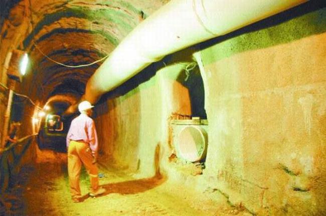
This tunnel below was not for trains, but drain pipes all along the route for the surface solutions... There's a new network of drain pipes that are being carried out with the SD Metro works, until all lines are done, the pipe network can't be fully used, but for some areas in the city.

You can call it the drainwater metro if you want for the scope of the tunnels and pipes.


230968544_2d856e02f5_o.jpg
 
May 5, 2007
9,246
92
0
You're correct and about that there was a recent debate by OPRET and MOPC on the matter.

All knew it was bound to happen in some location where bridges were built to take the current and extra water loads, but the access from both sides were not and that was due mostly to service life VS waiting until it was not an option to go fix it.

All these bridges presenting the same problem will get a new access engineering on both sides, even if only one side was affected. It was done on the Soco and others as well.

The studies were carried out about 4 years back and the plan was to wait until they ran their utility life and then fix them as the need came about.

The bridges are intact, including the supports and underground bases.

That part of the bridge can be taken care of as soon as the rain is gone from the sky...

It will be done much better and accounting for the water crest's line.

The plans to fix them were done a while back, so there won't be much delays in taking care of the problems.

The same happens for the streets that get flooded and stay flooded, they are mapped and solutions planned long term.

With all that planning and upgrades, don't they have a ribbon bridge, pontoon or even an old Bailey Bridge setup? with the frequent washouts in the DR you would think they would be more important than some of the other things spent on DR Military acquisitions
 

PICHARDO

One Dominican at a time, please!
May 15, 2003
13,280
893
113
Santiago de Los 30 Caballeros
With all that planning and upgrades, don't they have a ribbon bridge, pontoon or even an old Bailey Bridge setup? with the frequent washouts in the DR you would think they would be more important than some of the other things spent on DR Military acquisitions


The reason why there's no such need for that, it's due to how easy it's to create and mend the broken links as afforded by the above pictures. It's faster and cheaper to deploy earth movers and trucks there, than to ship a temporary bridge or military grade gimmick to the site. The military has no need for that, so it would be like a museum piece of art in their yards.

The majority of washouts in the DR are related to the way most older roads got done in the first place. The majority followed a simple trail that was there from carts and later cars, not a real road that was engineered or designed after studies.

The public works office has got to keep upgrading these links all around the country, but it's easier to just wait until such upgrades are needed, than going around disrupting traffic. As many of the older roads serve as the single and only link between towns or are the closest and fastest way from one point to the other.

Then there's the money and budget factors. As you can see, apart from the older roads, there's a lot of needs for new ones and upgrades to more important links.

But at least, now that the problem is shown, the later fix will be engineered and permanent!