
- Thread starter Robert
- Start date
You are using an out of date browser. It may not display this or other websites correctly.
You should upgrade or use an alternative browser.
You should upgrade or use an alternative browser.
Noel - More Photos...
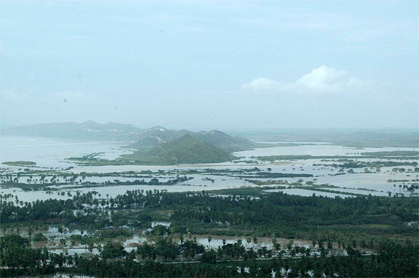
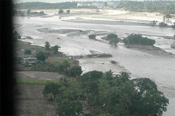
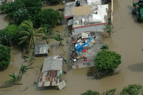
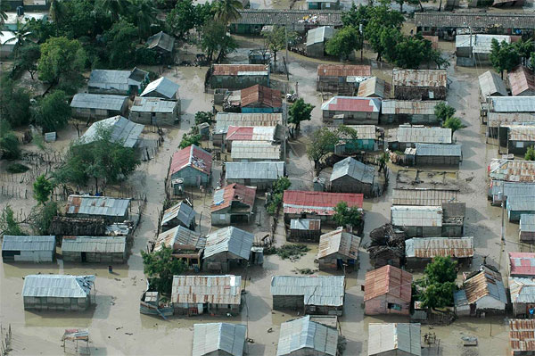
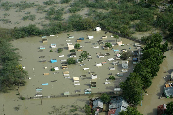
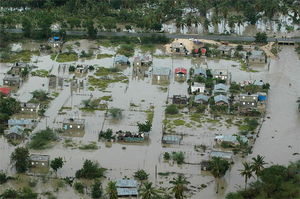
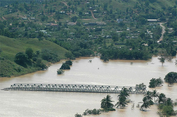
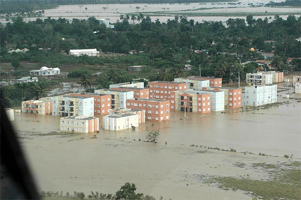
Absolutely incredible.
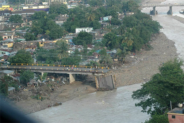
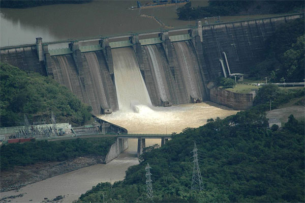
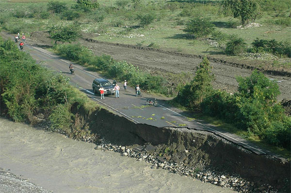
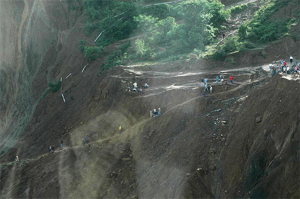
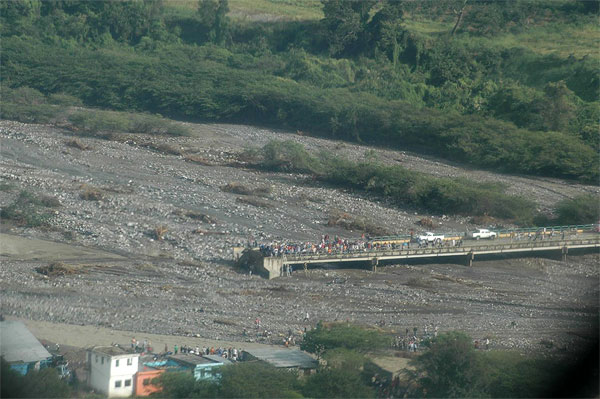
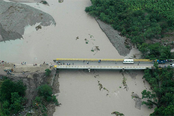
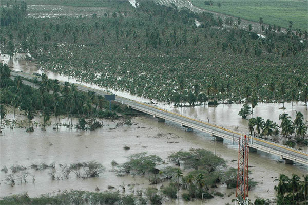
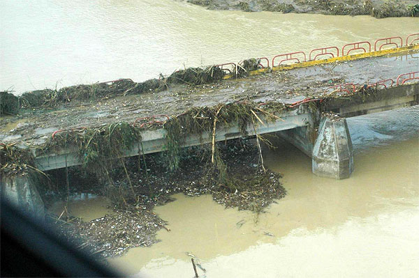
It really brings into focus, just how devastating the flooding was.
It really brings into focus, just how devastating the flooding was.
Last edited by a moderator:
Where and when were these taken?
Sent to me in a power point file. I have no idea.
I understand that there are topographic maps of the islands, I wonder if these have been used to analyzed and modeled to establish flood areas? This is relatively simple and we have been doing it in the States since the '50's. Heck, I could even do it too with some of the free programs that the ACOE has online.
it is a shame that time after time....all those poor who cant offord to buy a place to live or even rent, end up puttin gup their makeshift housing in these flood prone areas...because.... they are there and available...no one with money would build there!!!!
and when the rains and floods come.. they are totally wiped out again!!
I have seen if first hand in Santiago, La Vega, Sosua, and Santo Domingo...
too bad
bob
and when the rains and floods come.. they are totally wiped out again!!
I have seen if first hand in Santiago, La Vega, Sosua, and Santo Domingo...
too bad
bob