MotionX - for DR1 members it may be the best $2.99 app in the store... really! I've had this app for a few months, it's available in the App Store. Search for MotionX. There's a light version for free, but you won't regret the $2.99
Best Features:
Best Features:
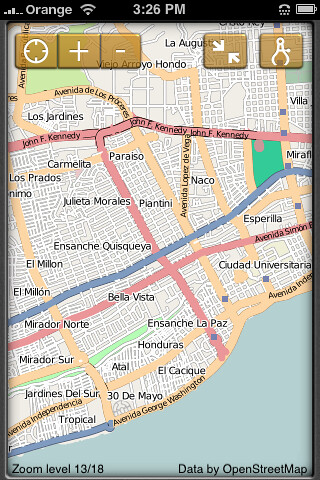
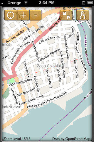
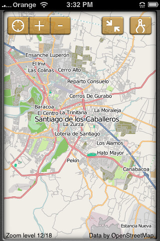
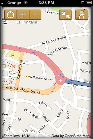
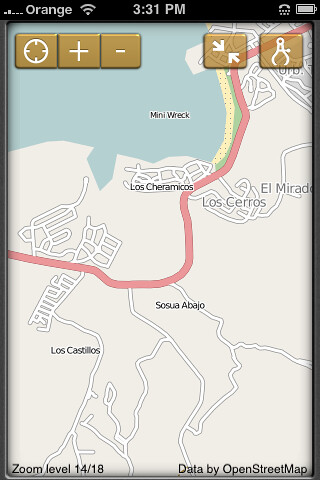
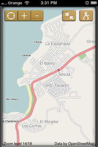
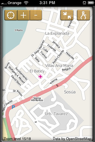
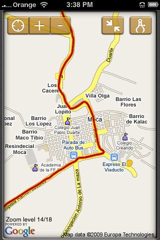
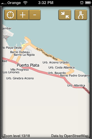
- Detailed maps of most larger cities.
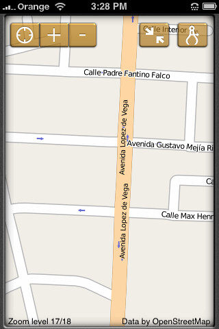
- Direction indication for many one-way roads.
- Road map & terrain map options with altitudes, etc.
- Maintains track
- Ability to take photos & tie to specific location
- Ability to share track information and photos to friends via e-mail, facebook, or twitter
- Ability to pre-cache maps up to 50MB (a lot of maps) when you're using wifi so you don't have to use the network to download maps as you move around.
- Turn by turn directions - either on screen or vocal
- Ability to put in destination & have estimated time of arrival, etc
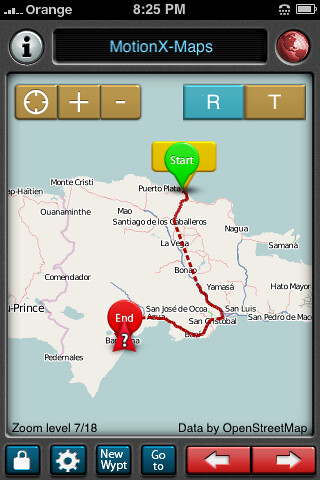
- I made a trip from the north coast to Barahona.
- The night before, I brought up the map screen and simply panned across the country at different detail levels to cache the maps. This put the maps in the iPhones memory so it didn't need to use the Orange network to grab map images as I went from place to place.
- Morning of trip, plugged the phone into the lighter socket in the car, and turned on the app. Took about 3 minutes to get the sat link.
- Turned on the Track feature
- Ready to go
- Car in motion (or you if you're walking) shows up on map. Accuracy is very good... as you pass an intersection, the map shows you right at that intersection.
- Track of trip - (dotted line shows where I had the GPS turned off for a while).
-
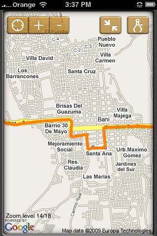
- Made a wrong turn in Bani on the way home while not paying attention. Actually used the GPS to get back to the right road. You can see my detour here
-
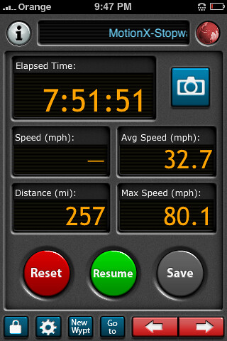
- Summary of trip - was actually about 6.5 hours. I failed to turn off the Track, which stops the clock.
-
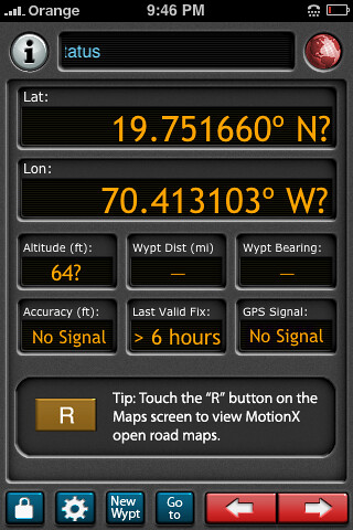
- current lat/lon/alt location. this image is without sat link, so it doesn't have all fields filled in as it normally would in use.
-
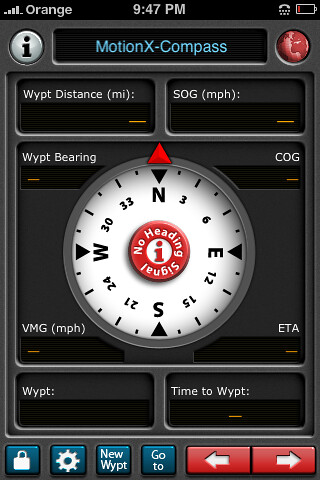
- Compass shows heading & speed on ground (SOG). Compass only works when you are in motion
-
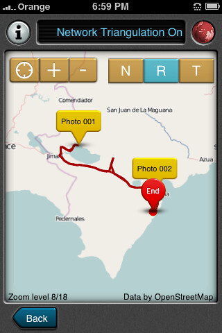
- track from trip to lago enriquillo. note sights where i took photos with the iphone
-
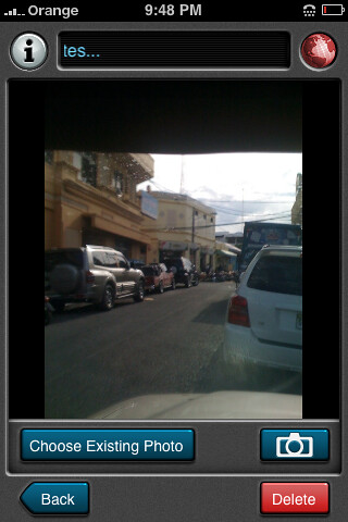
- Test photo from trip to see how it functioned in MotionX.
-
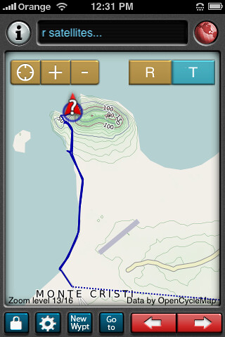
- Track from trip to Monte Cristi in Terrain format. Note altitudes are indicated on the map (relief map)
-
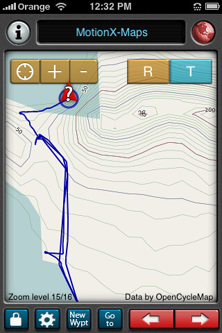
- Zoomed in track from Monte Cristi trip. You can see that I went back and forth on that road a few times... and at least for me, i can tell when i pulled into the parking lot... and then was on foot and walked out on the beach. If you're familiar with the beach there, you can probably tell as well.
-
- Next post (below) will include some random maps to show levels of detail available