2020 Hurricane Season

Status
Not open for further replies.

MikeFisher

The Fisherman/Weather Mod
Feb 28, 2006
13,771
2,206
113
Punta Cana/DR
www.mikefisher.fun
been now looking on the weather buoys on the way from SE towards PR.
from St Croix til Vieques the max recorded winds range on just 35mphr, and those are IN the windfield,
but so far nothing anywhere near TS Force winds recorded by any weather station or buoy.
 
  • Like
Reactions: caribmike

windeguy

Platinum
Jul 10, 2004
42,211
5,969
113
I have used windy.com to track storms for a couple of years. It as proven quite accurate. Was spot on for Isaiah.
NHC has maximum sustained winds at 40 mph for Laura at the moment.
 

MikeFisher

The Fisherman/Weather Mod
Feb 28, 2006
13,771
2,206
113
Punta Cana/DR
www.mikefisher.fun
Yes, it makes one think it the worst passes North.
by the atcual outlook the "worst" will pass all terrain of DR, from N to S and E to W.
what bothers me is the show dropped pressure but no rise on windpowers, teh opposite, the windpowers look way too weak for a TS.
there may be a 2nd Low Pressure Area in the SE Quadrant off the Surface Low(Center), not near the surface but mid level of the atmosphere.
such phenomenon can happen withinsuch wide area covering low category storms.
that would then not mean that Laura is intensifying windpowers, it would mean that the whole rainloads circulate around a mid level center many miles SE of the Surface Low(Center shown as Laura on the Maps), wandering directly in the wake of the SurfaceLow.
such phenomenon limits windspeeds and could be the explanation for the surrisingly low windspeeds measured by the numerous weather stations and weather buoys on the way so far.
usually such phenomenon does not last long, surface and mid level Low should come together and work as One, which then rises the windspeed again back to level.
such come together could show a little "jump" of Center again, but not by many miles.
it should not have a significant impact on the actually shown outlook of the NHC, a few miles more north or south will sorrily not make a difference on impact on DR this time, as it is big enough to keep us under it's strong portions as a country completely at a time.
 

caribmike

Gold
Jul 9, 2009
6,808
202
63
...or maybe better not to have it stalled and get rid of it as fast as possible? :/ It is moving pretty fast, isn't it?
 

william webster

Platinum
Jan 16, 2009
30,247
4,330
113
When a weather situation like this passes on the north, the mountains push it further north
away fro land

if this storm passes south of the mountains, wouldn't you expect it to be pushed south ??
 
  • Like
Reactions: MikeFisher

MikeFisher

The Fisherman/Weather Mod
Feb 28, 2006
13,771
2,206
113
Punta Cana/DR
www.mikefisher.fun
sorry that my stuff comes delayed, but i am in real internet trouble.
have to start uploads 2-3 times before a graph goes through.
this shot from 12:00PM today show's what I meant with different locations within the whole storm for the suface Low(Center of storm, RED dot)
and the mid level low pressure(yellow X), which is the actual Center of Circulation for the whole thing.
the Surface Low(RED) dictates the direction the whole storm will go, Yellow X will follow direction orders.

2020-08-22 (9)_LI.jpg
 

MikeFisher

The Fisherman/Weather Mod
Feb 28, 2006
13,771
2,206
113
Punta Cana/DR
www.mikefisher.fun
it is not a full fueled and circulating Hurricane, just a small Surface Low Pressure area.
that Center itself is small and touches very little ground(does not cover any wide area).
it may bounce a bit up and down along mountain ranges,
but the huge mass of rain areas behind it will over all follow the straight line and once they hit high mountains, such area can slow down/hang there for a while.
this is from 12:30PM today.
the strong rainfalls are S of PR and the circulation should enter them from the SE direction to the SE of PR now/soon.


2020-08-22 (10).png


2020-08-22 (11).png
 

aarhus

Long live King Frederik X
Jun 10, 2008
4,412
1,987
113
I have used windy.com to track storms for a couple of years. It as proven quite accurate. Was spot on for Isaiah.
NHC has maximum sustained winds at 40 mph for Laura at the moment.
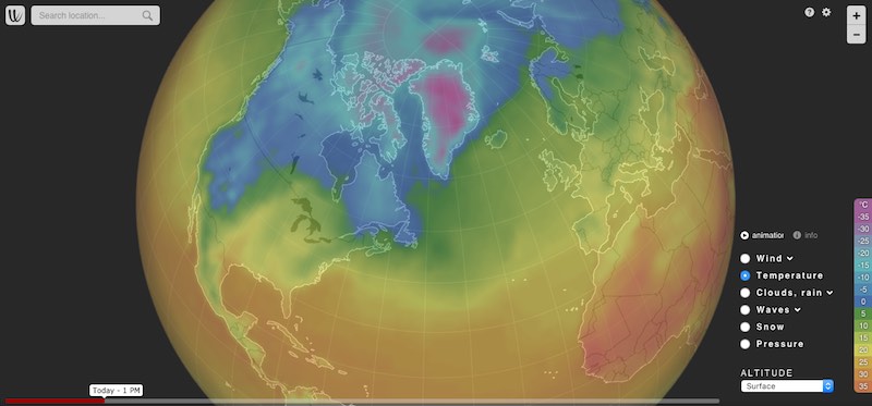
Have you looked at windy.com for this storm ?
 

MikeFisher

The Fisherman/Weather Mod
Feb 28, 2006
13,771
2,206
113
Punta Cana/DR
www.mikefisher.fun
no surprises so far.
the mid level Low and the Surface Low come together, for onestrong circulation.
NHC did upgrade the windspeeds now from 40 to 50 mphr, weather buoys around PR support that, too.
T-3hrs max til touch down in DR around our SE Corner.


2020-08-22 (12).png
 
Status
Not open for further replies.