2020 Hurricane Season

Status
Not open for further replies.

BermudaRum

Bronze
Oct 9, 2007
1,225
398
83
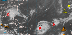
What a beautiful shot from Puerto Rican Meteorologist Ada Monzon.
around 6AM this morning, Hurricane Paulette over Bermuda, with the Island completely in the eye of the Hurricane.
the eyewall powers battered Bermuda with 90mphrs winds.
as for Size:
Bermuda is 21 miles long and 2 miles wide, so Paulette's eye measures ca 40 miles of a diameter.
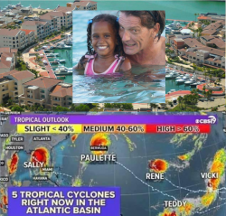
between tonight and tomorrow night the favorable conditions open a window for Paulette to become a Mayor Hurricane.
it will not threaten any other land than the just passed Bermuda.

You are correct Mike, at 6am the entire island felt like we were frozen in ice while the eye sat on us like a flying saucer 3 times our size. The predicted 2 hrs of sitting on us with her calm look, only lasted for 30 minutes, then boom. As you know it was time for her perfectly shaped tail to act up, and she didn't disappoint as she headed NNE.

I know this isn't DR related, however there is one thing I have learned about being warned about 15-20 good size hurricanes living in this island, and that is every hurricane has a different name for good reason. So next time you are sitting in the NC of the DR and hear that the south or the east of the DR will only be effected, still prepare and make sure your emergency supplies are ready because you may need them, along with everyone else in your area.

Now bring on Teddy!
 

MikeFisher

The Fisherman/Weather Mod
Feb 28, 2006
13,771
2,206
113
Punta Cana/DR
www.mikefisher.fun
while the <ap stays busy,
there is nothing in it for us Ilsanders here in DR.
we will just continue our sunny calm beach week.


2020-09-15.png
 

MikeFisher

The Fisherman/Weather Mod
Feb 28, 2006
13,771
2,206
113
Punta Cana/DR
www.mikefisher.fun
nothing new out there for us.
while the storms gain powers all around, none is interested in DR, that's GOOOD.

Orange Cross2 should not become a threat for anybody anywhere.
it has only max 48hrs to become a TD, then favorable conditions will end on it's path.
I don't think it will reach far enough West to be anywheer near the caribbean.
IF it would make it, it could max be a rainy tropical system misisng the Antilles on the NE,
but at this moment i do not see it that long-lived/not to come that far West.


2020-09-16_LI.jpg


Hurricane Terry is the powerful dangermachine.
a perfectly organized and fueld running hurricane with a perfect eye secured by a complete eyewall.
Terry will reach very high powers this week and pass us far out on our NE as a Cat4 Cyclone Power.
he will not be any danger for DR, but after it's pass we should get it's far end tailreaching also PR and DR.
the next maybe 24hrs it could seem thatTerry is loosing powers slightly/stops growing, but that will not be what really happens.
this storm will riseit's powers by many more notches, so it has to change the eyewall and widen it's eyediamter.
that will should happen somewheer between late tonight and late afternoon tomorrow.
once done it will right away start growing it's powers and very soon reach highest levels, Cat4 most likely.


2020-09-16 (2).png
 

Attachments

  • 2020-09-16.png
    2020-09-16.png
    1.9 MB · Views: 161
  • Like
Reactions: Brooklin

MikeFisher

The Fisherman/Weather Mod
Feb 28, 2006
13,771
2,206
113
Punta Cana/DR
www.mikefisher.fun
Sorry Mike, I couldn’t resist sharing this one.
that's photoshopped.
here come's the Original.
WE are Your Guides.

2020-09-17 (1).png


Teddy will pass as a powerful Mayor Hurricane Cat4 far out on our NE.
aside of some maybe covergae of it's farest SWern Tail, nothing for DR.
it's powerful windfield will stay very very far away from our Island.

Orange Invest, SSW of the Cabo Verde Islands, will never become any concern to anybody/any land.

the Map is full but the same time all is fine for us.
so our scared Canucks have to continue to feel the lil Shakes around the Island, because storm wise there is nothing to be scared about.

for this week and the coming weekend so far we look all GOOOOD.
 

Attachments

  • 2020-09-17 (1).png
    2020-09-17 (1).png
    1.4 MB · Views: 135

TropicalPaul

Bronze
Sep 3, 2013
1,366
614
113
that's photoshopped.
here come's the Original.
WE are Your Guides.

View attachment 3382


Teddy will pass as a powerful Mayor Hurricane Cat4 far out on our NE.
aside of some maybe covergae of it's farest SWern Tail, nothing for DR.
it's powerful windfield will stay very very far away from our Island.

Orange Invest, SSW of the Cabo Verde Islands, will never become any concern to anybody/any land.

the Map is full but the same time all is fine for us.
so our scared Canucks have to continue to feel the lil Shakes around the Island, because storm wise there is nothing to be scared about.

for this week and the coming weekend so far we look all GOOOOD.
Mike in this times when there is so much bad news, you are like a beacon, always positive and usually nice news that there isn't anything to worry about. Please keep it up, it's wonderful.
 

habi

Active member
Oct 17, 2015
335
128
43
Hurricane Teddy is loosing powers and will turn northwards before hitting Bermuda.

TS Wilfred will never become a threat for any landmass, it will not live long enough to reach any.

all stays quiet and fine for our Island.

Except the waves we will get on to the north shore from Teddy.... :(:(
 

etolw

Banned
Oct 6, 2018
816
195
63
Except the waves we will get on to the north shore from Teddy.... :(:(

Take advantage of them, Surfs up! :LOL:

The ‘‘wave season’’ in the Dominican Republic is between the months of September and April and surprisingly not crowded most of the time.

 
  • Like
Reactions: Brooklin

Cdn_Gringo

Gold
Apr 29, 2014
8,672
1,133
113
I haven't seen any warnings posted about waves or rip currents on the north coast yet. No small craft advisories as far as I have seen. While we do need some rain I am glad that Wilfred will degenerate into a trough in a day or two. Could be just what we need if it makes it this far.
 

habi

Active member
Oct 17, 2015
335
128
43
thats waht we are clear about since days already

Only mentioned it because you stated that " all stays quiet and fine for our Island."
For our shore it looks like an other week with no income for the water sport related companies exept surfing.... :(
 

MikeFisher

The Fisherman/Weather Mod
Feb 28, 2006
13,771
2,206
113
Punta Cana/DR
www.mikefisher.fun
our Tropical Highway cleared up, nothing left out there.

Habi, we are here reporting about possible storm threats to DR, local weather reports are not intended.
while you say your watersports are closed, we are here fishing every day on super calm offshore Sea, a calm bathtub up to 30nmls off our coastline.
I will attach the video of a Blue Marlin release, done Yesterday on my 42ft Bertram named Lady Lola,
because it show's clearly the Sea Conditions out there, which been that way all week long and still the same today,
as an effcet of the far out pass of Teddy.
in case of the pass of Teddy, the waves from it's storm surge been not felt down here yet, they "could" be felt by around mid week this week for us here on the southern tip of the East Shores. by the way and ancle it passed, I would guess those waves already been felt along the north and on the northern part of Samna Peninsula, but that i just assume, I don't know such, as such thing can only be observed Locally at each part/bay of a coast, it can not be predicted from far away/by a glimpse on a satellite map, for such storm which passed so very far away and anyways lost powers significantly well earlier than expected.

as conditions over our Tropical Highway are after the heavy storm presence from past week almost free of dry air, barely windhsear present,
we could really need a week without any systems running through there, because those actual conditions are the best of the year so far, to let even weaker systems get their act together and form a storm.

the long range outlook for this week does not show anything expected to pop up,
so it looks good to get some harsher(rough for storm development) conditions out there,
so the systems to come for the rest of our still young season will not start under perfect development conditions.

for this week, at this moment, it looks like we will all stay fine and free of stormy worries.


william webster

Platinum
Jan 16, 2009
30,247
4,330
113
Yes Mike.... since Friday the North coast has had bigger than normal waves.

They're dying down today

I can see the new wisdom you acquired by adding another year to your age !!
Looks good on you....👴

hahaha

Thanks
 
Status
Not open for further replies.