
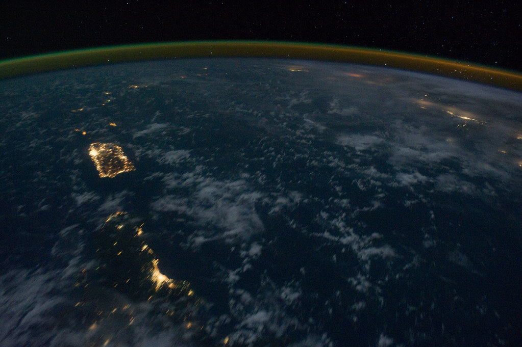
Here is an interesting map of the light pollution in Central America and the Caribbean. Some of the most interesting findings is how bright Puerto Rico is at night, the stark dichotomy between the Dominican Republic and Haiti, the extreme brightness of the Mexican oil fields in the Bay of Campeche (Gulf of Mexico near the Yucatan peninsula).
Also, Florida looks amazing and in the Lesser Antilles, apparently most of the population concentrates on the western shore of each island, possibly due to the hurricanes that tend to arrive from the east. This is quite notorious on the island of Trinidad, off the northeastern coast of Venezuela. Through out the Caribbean, the beaches on the Caribbean side tend to be calmer and nicer than the one's facing the Atlantic, so maybe tourism development has something to do with that too.
Light pollution in the Dominican Republic tends to show quite well the population distribution, most of which concentrates in Greater Santo Domingo plus San Crist?bal province (some 4 million people) and the Cibao Valley (roughly 3.5 million); in other words, almost 80% of the population.
 This image, among others, was provided by NASA.
Also, Florida looks amazing and in the Lesser Antilles, apparently most of the population concentrates on the western shore of each island, possibly due to the hurricanes that tend to arrive from the east. This is quite notorious on the island of Trinidad, off the northeastern coast of Venezuela. Through out the Caribbean, the beaches on the Caribbean side tend to be calmer and nicer than the one's facing the Atlantic, so maybe tourism development has something to do with that too.
Light pollution in the Dominican Republic tends to show quite well the population distribution, most of which concentrates in Greater Santo Domingo plus San Crist?bal province (some 4 million people) and the Cibao Valley (roughly 3.5 million); in other words, almost 80% of the population.
")

