
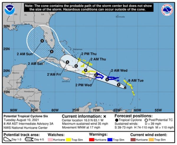
The National Hurricane Center of the United States warns of the low-pressure area making its way west towards the Caribbean. NHC says that the environmental conditions make for additional development. Tropical Cyclone Six is expected to become Tropical Storm Fred as it crosses the Caribbean.
The system is now moving west-northwestward at speeds of 16mph. The NHC reports that the disturbance will affect the Lesser Antilles on Monday, 9 August in the evening, and then move near the US Virgin Islands and Puerto Rico on Tuesday, 10 August 2021 and Hispaniola on Wednesday, 11 August.
NHC urges the monitoring of the progress of the system as it moves towards Caribbean waters.
The National Meteorological Office (Onamet) has issued watches for the country to monitor a tropical wave moving across the country and the imminent tropical storm. Heavy rains, flash flooding and mudslides, gusty winds and rough seas are forecast.
Meanwhile, the Center for Emergency Operations (COE) and Onamet declared a watch (green alert) for 13 provinces, due to rains caused by the passing tropical wave and a trough. The provinces under alert are La Vega, Monte Plata, La Altagracia, Monseñor Nouel, Hato Mayor, Samaná, Sánchez Ramírez, Duarte, María Trinidad Sánchez, San Pedro de Macorís, La Romana, Hato Mayor and El Seibo. The COE and Onamet also called for the population to prepare for the effects of possible TS Fred.
Read more in Spanish:
Diario Libre
NHC
DR1 Weather
El Caribe
Noticias SIN
10 August 2021