
The storm system moving our way has a short window with good development conditions starting Tuesday, but favorable conditions will not last long. Mike Fisher explains that the developing system is already north of what is known as “the danger path.”
MikeFisher explains that given the steering winds, the developing system could never move straight West, to affect the Dominican Republic.
“Its heading will be WNW and that direction will make it pass close but out NE of the Islands,” explains the weather forecaster.
He said the systems pushed westward by tropical waves do their best to clean up the storm pavement, but the conditions are not in place for anything mayor.
Meanwhile, the National Weather Office (Onamet) Monday, 29 August forecast indicates:
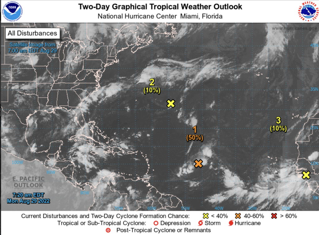
“We are monitoring an area of showers and thunderstorms associated with a trough located in the tropical central Atlantic, with a 50% probability of reaching tropical cyclone status during the next 48 hours. In addition, we are following the evolution of another area of low pressure located hundreds of kilometers east of Bermuda, with a 10% in 48 hours to become a possible tropical cyclone. In addition, another new area of downpours associated with a tropical wave coming out of Africa is observed.”
Onamet forecasts hot summer temperatures will prevail and recommends the population to keep hydrated, wear light clothing, and not expose themselves directly to the sun’s rays from 11 to 4pm.
Read more:
DR1 Weather
Onamet
Diario Libre
30 August 2022