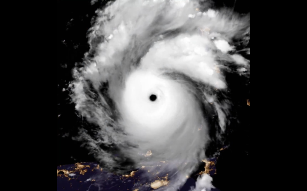
The good news is that Hurricane Beryl is on a fast western track at around 32kph (20mph). The storm is not expected to directly hit the Dominican Republic, albeit the Pedernales and Barahona provinces are under red alert and tropical storm watch for wind and surf damages.
The Center for Emergency Operations has 21 provinces under weather alert for tropical storm force winds, storm surges and swells, and flooding. These are green alerts for La Altagracia (Punta Cana), La Romana (Casa de Campo), San Pedro de Macoris (Juan Dolio), Monte Plata, Sanchez Ramirez (Cotui), Santiago, Espaillat (Moca), Hermanas Mirabal (Salcedo) are under green alert. Independencia, Azua, La Vega, Monseñor Nouel, San Jose de Ocoa, San Cristobal, Peravia and Greater Santo Domingo (National District and Santo Domingo province) are under yellow alert. Pedernales and Barahona, the southwestern tip of the country, are the two provinces under red alert.
The Dominican Republic, nevertheless, is preparing for the potential impacts of Hurricane Beryl as it moves westward through the Caribbean. While the storm’s center is not expected to make direct landfall on the Dominican Republic, the country is still taking precautionary measures:
• The Dominican government has activated its emergency protocols and convened the national emergency committee to monitor the situation.
• Coastal provinces in the Dominican Republic have been placed under green, yellow or red alert.
• Authorities are warning residents to take necessary preparedness actions, such as securing their homes and property, stocking up on supplies, and heeding any evacuation orders from local officials.
• The Dominican Meteorology Office (Onamet) has stated that the storm’s outer bands of wind and rain are expected to begin affecting the southern coast of the Dominican Republic on Tuesday and into Wednesday, and has advised the public to take normal hurricane precautions.
• While Beryl is not expected to make a direct hit, the Dominican Republic is still preparing for potential flooding, storm surge, and other indirect effects from the powerful hurricane as it passes south of the country.
All predictions computer models show the storm on a sustained path that should keep it well below the Dominican Republic.
The storm is expected to pass 330 km south of Santo Domingo on Tuesday, 2 July 2024 at around 2pm.
Moving on the heels of Beryl is another unnamed system (96L). Reports from the NHC is that the system is moving on a similar track to Beryl but is still disorganized. Between the remaining Saharan Dust and the upper winds of Beryl, forecasters say this follow-up storm is less conducive to strengthening as was the case of Beryl.
Read more in Spanish:
Hoy
University of Wisconsin
COE
Noticias SIN
El Caribe
N Digital
2 July 2024

