
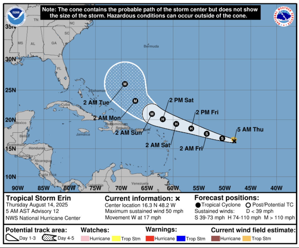
Tropical Storm Erin continues on its westward course. As of Wednesday, 13 August in the afternoon, Erin was located approximately 2,050 km east of the Lesser Antilles, moving westward at a speed of 28 km/h. The system is expected to maintain its westward trajectory, gradually decreasing in speed over the coming days and turning to the north.
Meanwhile, Erin is producing maximum sustained winds of 75 km/h, with higher gusts, and forecasters anticipate a gradual strengthening in the days ahead. Most spaghetti tracks show the storm heading north away from the Caribbean.
Nevertheless, authorities are closely monitoring the storm’s development and path, urging the public to stay informed through official updates.
Isolated showers are forecast for the weekend, but for the most part, the Saharan Dust continues to bring grey skies and lots of sunshine.
The sweltering heat is what is most affecting the Dominican Republic these days. As the summer season brings high temperatures, health officials are advising the public to take precautions against heat-related illnesses. People are urged to avoid direct sun exposure without protection between 11am and 5pm, stay well-hydrated by drinking plenty of water, wear light-colored, breathable clothing, and seek out cool, ventilated spaces. Extra care should be taken for children and the elderly, who are particularly vulnerable to extreme heat.
Follow the weather:
Indomet
NHC
14 August 2025