
With still two weeks before the brunt of the hurricane season starts in September, Hurricane Erin served as a wake up call for Dominicans. MikeFisher weather forecaster for DR1 described the storm as “this very out of the ordinary Super Storm Erin.” He wrote: “I don’t remember a storm growing from TS to Cat5 that fast, there for sure have been just a few in history. And a Cat5 around our turf already by mid-August, I assume, the historics will also name out of the ordinary. It shows how ready ocean surface temps and all around conditions are out there on our highway.”
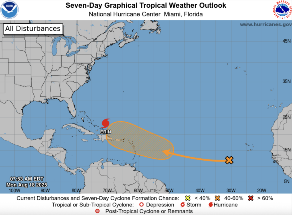
Hurricane Erin indeed is a fickle storm that seemed to have not made up its mind where to hit and instead chose a path that is taking it to open Atlantic Ocean waters.
The storm intensity has been up and down, fluctuating from a Category 3 storm to a Category 5 storm. But the good news iss that as forecasted, the storm swerved to the north, in time to spare the DR of its impact. As of Monday, its path also bodes well for the Bahamas, Bermuda and the United States, too. But as with these storms, constant monitoring is in order.
Meanwhile, on Sunday, 17 August 2025, Santo Domingo was a breeze, with people seeming to have taken the possibility of heavy rains serious and traffic being much less than usual. The capital city experienced continued wind gusts and light rains on Sunday.
The Center for Emergency Operations is warning of the risk that the large storm will bring rains that could cause urban flooding. The COE placed the entire northern and eastern coast of the Dominican Republic under yellow alert for possible flooding.
DR1 Weather provides excellent storm weather coverage with a focus on the country, thanks to the expert posts by MikeFisher for DR1 Forums.
Read more:
DR1 Weather Reports
Diario Libre
Listin Diario
18 August 2025