
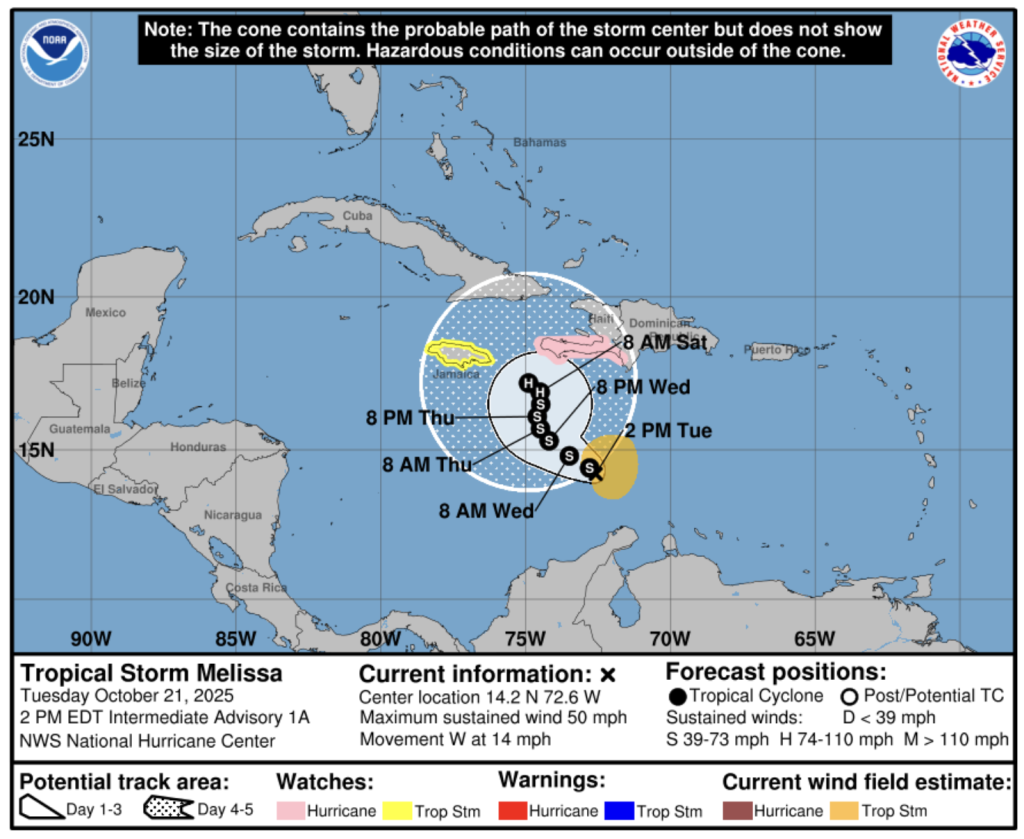
Gloria Ceballos, the director of the National Weather Institute, says the country needs to prepare for the worst scenario from newly formed Tropical Storm Melisa. The worst scenario translates to historic rainfall.
Ceballos drew a stark comparison, referencing the 267 millimeters that fell on the National District on 4 November 2022, and the over 400 millimeters recorded on 18 November 2023, which resulted in catastrophic flooding. She said that 300 millimeters can be expected between Wednesday, 22 October and Thursday, 23 October.
“To give you an idea of the rainfall totals expected with this system… it has a wide cloud field,” Ceballos emphasized, urging the public to take the threat seriously.
The weather system is on track to pass to the south and is expected to bring intense rains, wind gusts and abnormal waves, especially to the Caribbean coast. The storm could impact from La Altagracia (Punta Cana), La Romana, Greater Santo Domingo, Peravia (Bani) and San Cristobal.
Yellow alerts have been issued for Greater Santo Domingo, San Cristobal, Peravia, Azua, Barahona, San Jose de Ocoa, San Juan, La Romana, La Altagracia, Hato Mayor, El Seibo and Monte Plata.
The Center for Emergency Operations (COE) and the National Weather Institute (Indomet) warns rainfall totals could exceed 300 millimeters across various parts of the country.
Read more in Spanish:
Indomet
NHC
N Digital
El Dia
21 October 2025