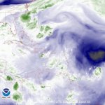
2018 Hurricane Season

william webster

Platinum
Jan 16, 2009
30,247
4,330
113
i think Mike is in Germany now --
he said he would stay on the hurricane watch but only for emergency type situations.

Don't call me -- I'll call you
type of scenario

Or as Neil Simon would say
Same Time Next Year
 

ljmesg

New member
Aug 6, 2017
526
1
0
Tropical Depression Two
a873cb49ba4a654bcc58f0d88c9ebcdf.jpg
 

Olly

Bronze
Mar 12, 2007
1,914
104
63
From the National hurricane Centre :

TCUAT2

Tropical Storm Beryl Tropical Cyclone Update
NWS National Hurricane Center Miami FL AL022018
230 PM AST Thu Jul 05 2018

...DEPRESSION BECOMES TROPICAL STORM BERYL...

Satellite imagery indicates that the tropical depression has
strengthened and is now Tropical Storm Beryl. Maximum sustained
winds are estimated to be 40 mph (65 km/h) with higher gusts. An
updated intensity forecast will be provided with the 500 PM AST
(2100 UTC) advisory.


SUMMARY OF 230 PM AST...1830 UTC...INFORMATION
---------------------------------------------------
LOCATION...10.3N 42.3W
ABOUT 1330 MI...2140 KM ESE OF THE LESSER ANTILLES
MAXIMUM SUSTAINED WINDS...40 MPH...65 KM/H
PRESENT MOVEMENT...W OR 275 DEGREES AT 16 MPH...26 KM/H
MINIMUM CENTRAL PRESSURE...1007 MB...29.74 INCHES

$$
Forecaster Brennan/Berg


################

Olly and the Team
 

j&t's future

Bronze
Mar 6, 2007
2,502
27
48
Still early days for Beryl, I'm sure if she develops more beyond Sunday (which is unlikely), Mike will be on the case.
 

Olly

Bronze
Mar 12, 2007
1,914
104
63
From the National hurricane Centre :

Hurricane Beryl Advisory Number 4
NWS National Hurricane Center Miami FL AL022018
500 AM AST Fri Jul 06 2018

...TINY BERYL BECOMES THE FIRST HURRICANE OF THE 2018 ATLANTIC
HURRICANE SEASON...


SUMMARY OF 500 AM AST...0900 UTC...INFORMATION
----------------------------------------------
LOCATION...10.6N 45.1W
ABOUT 1140 MI...1830 KM ESE OF THE LESSER ANTILLES
MAXIMUM SUSTAINED WINDS...75 MPH...120 KM/H
PRESENT MOVEMENT...W OR 275 DEGREES AT 14 MPH...22 KM/H
MINIMUM CENTRAL PRESSURE...995 MB...29.39 INCHES


DISCUSSION AND OUTLOOK
----------------------
At 500 AM AST (0900 UTC), the center of Hurricane Beryl was located
near latitude 10.6 North, longitude 45.1 West. Beryl is moving
toward the west near 14 mph (22 km/h). A faster west-northwestward
motion is expected through the weekend. On the forecast track, the
center of Beryl will remain east of the Lesser Antilles through
early Sunday.

Satellite data indicate the maximum sustained winds have
increased to near 75 mph (120 km/h) with higher gusts. Some
additional strengthening is forecast today. Beryl is forecast to
quickly weaken by late Saturday and become a tropical storm or
degenerate into a strong open trough near the Lesser Antilles late
Sunday or Monday.

Beryl is a very compact hurricane. Hurricane-force winds extend
outward up to 10 miles (20 km) from the center and
tropical-storm-force winds extend outward up to 35 miles
(55 km).

The estimated minimum central pressure is 995 mb (29.39 inches).


###################

Olly and the Team
 

MikeFisher

The Fisherman/Weather Mod
Feb 28, 2006
13,771
2,206
113
Punta Cana/DR
www.mikefisher.fun
Beryl is a Tropical Cyclone, max powers would be a short lived status as a Hurricane.
our Island/Caribbean protecting conditions East of the Islands are nicely up as our protection shield.
the last almost 1000 miles towards the Island Belt are actually strong enough to knock down any Hurricane Formation that would close in on our Tropical Highway from our East towards the Caribbean, so nothing to fear out there at this point.
the máximum powers this Tropical Cyclone Beryl could have, when entering the Eastern Caribbean Sea, is as a simple Tropical Wave.
while I watch all upcoming and of course active stormy áreas, even now that i am for 2months on vacation in Europe,
my detailed Observations, Reports and Warnings will be published only for Systems/Storms which could become dangerous for our Island.
this Beryl i do not give a chance to become dangerous for teh Island.
we keep an eye on it of course, as you never know,
but by now nothing out there looks any dangerous for the Island Hispañola.
by now, all significant factors/conditions call for several more danger-free weeks ahead of us.
the over all long range Outlook(of course with all it's known uncertanties) looks great for this season.
Happy Travels to All
 

Dolores1

DR1
May 3, 2000
8,215
37
48
www.
In its weather report for Friday, 6 July, Onamet, the local weather service states: "This last system [Beryl] does not represent a danger for the Dominican Republic.

Of course, as all weather people will tell you, and experience shows, any storm in our area needs to be closely followed.

Regardless, this is the time to complete preparations for a strong hurricane. We are on the hurricane path of the Caribbean and this means that at any time the island could be hit by a big storm. It is best to always be prepared.

Preparations include checking that what we have in place to protect our property is in working conditions. Just do a mental check and think if the storm would be coming tomorrow, what you would need to keep safe.

And... always keep in mind to be always prepared for an earthquake. That means, among other preventions, simple things such as screwing armoires and shelving to the wall, so if the land shakes all that is inside doesn't fall out.
 

Caonabo

LIFE IS GOOD
Sep 27, 2017
7,339
2,949
113
Haiti in the cross-hairs again, but really too early to call what will happen.

143801_5day_cone_with_line_and_wind.png

I do not understand as that there are postings in the last hours that state yes be concerned, and others that state no do not be concerned. Your graphic cone shows the RD right within this cyclonic event.
 

Cdn_Gringo

Gold
Apr 29, 2014
8,673
1,136
113
Hurray, maybe some moderate rain for my parched patch of greenery Monday night. I hope for nothing more.
 

MikeFisher

The Fisherman/Weather Mod
Feb 28, 2006
13,771
2,206
113
Punta Cana/DR
www.mikefisher.fun
Beryl already passed it's strengthening phase/peak point.
from now on the over all tendency will be a weakening one.
so now we have to wait tilit has passed the Lesser Antilles and wanders in the Eastern Caribbean Sea,
as by then we will see strength tendencies and Direction of Movement.
it is expected to wander over the Islands sunday night/monday morning
and it looks like it will be a weak Tropical Storm only by then.

070718.jpg

this shot from 7:45AM AST this morning show's the 3 active zones on the western atlantic.
TD3 off the East of the USA, Top middle of the shot.
Hurricane Beryl, on the right bottom corner.
and the weak Tropical Wave in the Eastern Caribbean Sea.

as far as influences on our Island go, the first one to look on is the Tropical Wave in teh Eastern Caribbean Sea.
it is nothing big nor threathening, but it should bring some rain along the southshores during the next 48hrs.
and of course Beryl, right behind, actually a good 700 miles East of the Lesser Antilles,
which does not show any significant amounts of wáter. also the windforces of Beryl do not reach out far from the Center, so most influence this one has only where it runs right over.
I guess a 50nmls off the center of Beryl you can ly out in the sand and get a Tan without any Breeze to be felt.
 

MikeFisher

The Fisherman/Weather Mod
Feb 28, 2006
13,771
2,206
113
Punta Cana/DR
www.mikefisher.fun
even not of any interest for our Island, but just to complete the whole western atlantic picture,
i forgot to mention the Tropical Wave in the souther Gulf, the Bay of Campeche.
it is a active one and still has chances to form something out of it.
behind Beryl we also have an other 2 Tropical Waves running,
but by now they do not look like they stand a chance to do anything other tan their usual duty, means to carry moisture from the African Westshores over the Tropical Highway to the Caribbean/Central America.
 

Drake

Bronze
Jan 1, 2002
667
23
18
Disturbance 1: 0% Chance of Cyclone Formation in 48 Hours
As of 8:00 am EDT Mon Jul 9 2018 ...
An area of showers and thunderstorms associated with the remnants
of Beryl is producing locally heavy rainfall and strong gusty winds
over the northeastern Caribbean Sea and the northern Leeward
Islands. The disturbance is expected to move west-northwestward
for the next day or so, passing over the Virgin Islands and Puerto
Rico today, and over Hispaniola tonight. Unfavorable upper-level
winds and interaction with land should prevent redevelopment during
the next day or two, but environmental conditions could become
somewhat conducive for regeneration of a tropical cyclone later this
week when the system is forecast to turn northward over the Bahamas
and the western Atlantic. Additional information on this system can
be found in High Seas Forecasts issued by the National Weather
Service.
* Formation chance through 48 hours...low...near 0 percent
* Formation chance through 5 days...medium...40 percent