DOMINICAUS:
Because you are young and not well educated as to things "Hurricane-related" let me fill you in:
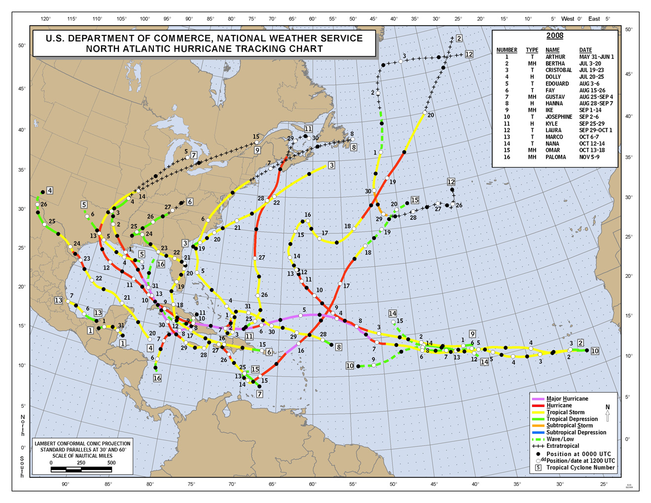
If you look above at that very colorful map of all of the hurricanes for which there is data, you will see that only one (a green line) went directly across the island. Only one! And I lived through that. It was David on
31 August 1979. I lost over 100.000 US that evening!
Let me also point out that on the North Shore there are many buildings of over 100 years old. In Gaspar Hernandez, Puerto Plata, Monte Cristi, and they are wood...did you read that? WOOD....I tell people my beachhouse is over 50 years old and has never (knock on wood) been bothered by a hurricane.
And to you know why? Because of the Septentrional Mountains. As the hurricane sweeps by on the North, its winds keep getting stuck on those mountains and it quickly loses power...That is why.
So do yourself a favor and watch and learn and maybe in 50 years you can give people some good advice...Like I am trying to do...
HB
Take this man's advise, he is very wise