
A cold front drafting east to Puerto Rico is bringing drier air and noticeably cooler temperatures across the Dominican Republic starting this Monday, 2 February 2026. The evening and early morning were marked by intense wind gusts felt in the National District.
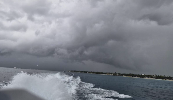
Weather Institute (Indomet) reports that coastal and mountainous regions should remain on alert for intermittent rain and hazardous maritime conditions.
Despite the arrival of drier air, a combination of cool northerly winds and local terrain effects will keep the skies cloudy. Indomet reports that residents should expect moderate intermittent showers starting in the morning, particularly in the Atlantic Coast: Puerto Plata, Espaillat, María Trinidad Sánchez, and Samaná; the Cibao Valley provinces from Montecristi to Monsenor Nouel; and the southwest, including Barahona, and Pedernales.
Indomet reports that thermometers nationwide are beginning a downward trend due to the influence of the cold air mass. Temperatures will feel pleasantly cool to chilly during the night and early morning hours, with the most significant drops occurring in interior valleys and mountain towns. Small and medium-sized vessels are ordered to remain in port on the Atlantic Coast, from Manzanillo (Montecristi) passing by Samana all the way to Cabo Engaño (La Altagracia – Punta Cana).
No restrictions for maritime activities in in place, though, for the Caribbean coast, according to the Indomet forecast.
Temperatures are expected to decline in the Greater Santo Domingo area to dip as low as 16°C to 18°C. In mountainous regions like Constanza and Jarabacoa, temperatures could reach between 10°C and 12°C, with even lower readings in high-altitude areas like Valle Nuevo.
For the remainder of the week, meteorologist Jean Suriel warns of heavy swells and polar air coming south to the Dominican Republic. He explains the weather is the result of a massive atmospheric phenomenon known as a “bomb cyclone” that is currently developing in the Atlantic Ocean. While its center remains thousands of miles away, its expansive reach is set to disrupt weather patterns across the Dominican Republic for the next five to six days.
According to meteorologist and weather analyst Jean Suriel, the system is situated east of the United States and is tracking toward Canada. However, its immense circulation is acting as a seasonal engine, pushing cold fronts and troughs directly into the Caribbean basin.
A bomb cyclone is a powerful, fast-developing storm that undergoes a rapid drop in atmospheric pressure—at least 24 millibars within 24 hours. This “explosive” intensification creates a system comparable to a winter hurricane, capable of generating fierce winds and massive swells that impact regions far beyond the storm’s core. The bomb cyclone could explain the wind gusts.
The most immediate concern for the coastline is the “mar de fondo” (heavy groundswell). Suriel warns of waves reaching heights of 8 to 10 feet along the Atlantic coast from Punta Cana on the East to Puerto Plata on the North. Small craft are advised to remain in port, and coastal activities, including fishing and water sports, may be restricted due to the hazardous surf.
Follow the story in Spanish:
Indomet
CDN
Jean Suriel
2 February 2026