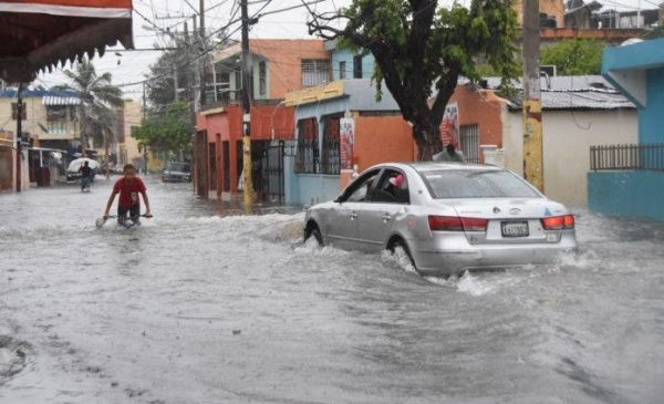
It was forecast to become Tropical Storm Fred as it crossed the Dominican Republic, but on Wednesday, 11 August 2021, the storm became Tropical Depression #6. Fred would enter via Haina, west of the National District, taking a path similar to Hurricane David (1979), the most devastating hurricane to affect the Dominican Republic. Reports are that the sun was shining for most of the day in Punta Cana (La Altagracia) and La Romana to the East, and Barahona to the West. Only light rains were reported for the north coast but these were enough to cause flooding in areas such as El Limón in Samana.
Tropical Depression Fred brought wind gusts that downed trees and billboards in Santo Domingo, and flooded the streets causing major traffic jams in the capital city and Santo Domingo East. In the Boca Chica area, where Las Americas International Airport is located, there were reports of boats at the Santo Domingo Yacht Club that sunk and others that suffered damages. Dozens of flights scheduled to land in Las Americas were delayed, canceled or diverted to Punta Cana.
The wind gusts reached up to 75 kph, yet the rains were relatively light but long lasting in Santo Domingo. The storm brought to the open the most vulnerable areas. It served as a practice drill for the hurricane peak that is historically in the month of September.
The intense rains also affected the central areas of the Dominican Republic, as it diagonally crossed the country. The storm exited in the late evening by way of the northwestern border with Haiti. Rains are expected to continue all day on Thursday.
A new storm is developing off Africa, and MikeFisher of DR1 Weather recommends closely monitoring this disturbance. He reports that contrary to Fred, the upcoming system has the potential to develop into a big storm that could affect the Dominican Republic.
Read more:
DR1 Weather
Hoy
El Dia
El Caribe
El Caribe
N Digital
Diario Libre
12 August 2021

