Today, Santo Domingo is the largest urban area in the Caribbean and one of the most extensive on an east-west direction in the Americas. This wasn't always the case, in fact its a recent creation. Similar to wood structures, which as recent as the 1980's and even beginning of the 1990's most homes were made of wood, one of the trends as Dominicans see an increase in their disposable income is to rebuild the original house or a new one in cinderblock and reinforced concrete; so too has the city grown. Now building houses of wood is rare. The rebar, cement, and cinderblock business appears to be very lucrative. Like in neighboring Puerto Rico, wooden homes are definitely becoming extinct despite they still make up the cultural image of the DR and is often used to show "Dominicaness" to tourists, including offering tours of wooden homes to show the visitor the "typical" lifestyle despite studies have shown that over 90% of Dominican houses are now cement and block.
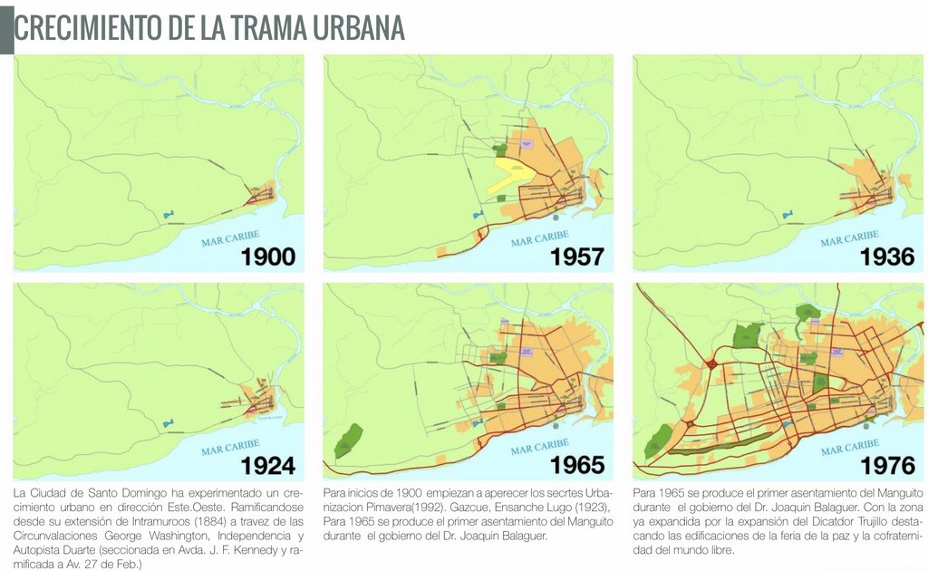
The 1924 map is the closest to what Trujillo knew of Santo Domingo when he rose to power in 1930 and 1957 the closest when he was eliminated in 1961. Santo Domingo was considered to be one of the cleanest and safest capitals in Latin America, and was noted by urbanists and architects for taking into account beauty with an emphasis in Mid-Century Modern and Art Deco styles and greenery in applying the City Beautiful concept particularly in Gascue. After Trujillo's death and following much of the 1960's, Santo Domingo was subject to a free fall as people started flooding into the city and built what they wanted where ever they wanted, not taking into account a general urban planning that would had guaranteed wide roads, specific trees lining the sidewalks, underground wiring, etc. The migration pressure certainly took what was a relatively small, calm, clean, beautiful city and in a few decades turn it into a large, noisy, littered, traffic clogged mostly bland architecture sea of cement.
The maps are approximates, not exact representations. I say this because the Santo Domingo Country Club begins to appear on the map of 1965, yet it was the first golf course built in the Dominican Republic and it happen to be a project of the US Military in the 1920's. In fact, they left in 1924 and the golf course was already built and functioning by then. It should had been in the 1936 and 1957 maps too.
The yellow area in the 1957 map is of General Andrew Airport, the first international airport of Santo Domingo. There was an airplane accident that crashed into the Mejoramiento Social neighborhood. That was the moment Trujillo ordered a new airport to replace General Andrew Airport. The new one was built on the western shore of the Caucedo Peninsula and named "Trujillo Airport". After Trujillo's death the airport had a name change and became "Las Americas Airport".

 issuu.com
The 1924 map is the closest to what Trujillo knew of Santo Domingo when he rose to power in 1930 and 1957 the closest when he was eliminated in 1961. Santo Domingo was considered to be one of the cleanest and safest capitals in Latin America, and was noted by urbanists and architects for taking into account beauty with an emphasis in Mid-Century Modern and Art Deco styles and greenery in applying the City Beautiful concept particularly in Gascue. After Trujillo's death and following much of the 1960's, Santo Domingo was subject to a free fall as people started flooding into the city and built what they wanted where ever they wanted, not taking into account a general urban planning that would had guaranteed wide roads, specific trees lining the sidewalks, underground wiring, etc. The migration pressure certainly took what was a relatively small, calm, clean, beautiful city and in a few decades turn it into a large, noisy, littered, traffic clogged mostly bland architecture sea of cement.
The maps are approximates, not exact representations. I say this because the Santo Domingo Country Club begins to appear on the map of 1965, yet it was the first golf course built in the Dominican Republic and it happen to be a project of the US Military in the 1920's. In fact, they left in 1924 and the golf course was already built and functioning by then. It should had been in the 1936 and 1957 maps too.
The yellow area in the 1957 map is of General Andrew Airport, the first international airport of Santo Domingo. There was an airplane accident that crashed into the Mejoramiento Social neighborhood. That was the moment Trujillo ordered a new airport to replace General Andrew Airport. The new one was built on the western shore of the Caucedo Peninsula and named "Trujillo Airport". After Trujillo's death the airport had a name change and became "Las Americas Airport".
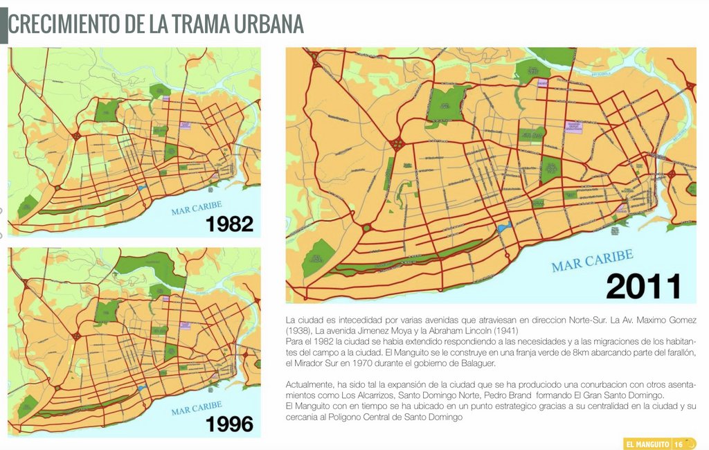
Analisis del lugar, Barrio El Manguito
Issuu is a digital publishing platform that makes it simple to publish magazines, catalogs, newspapers, books, and more online. Easily share your publications and get them in front of Issuu’s millions of monthly readers. Title: Analisis del lugar, Barrio El Manguito, Author: luis perez ferreras...
Last edited: