- Thread starter Cdn_Gringo
- Start date
You are using an out of date browser. It may not display this or other websites correctly.
You should upgrade or use an alternative browser.
You should upgrade or use an alternative browser.
Earthquakes in the DR
I suppose some of those faults connect to DR? ( Thinking that’s the last thing PR needs now, a quake of substantial size).
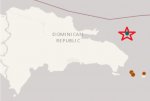
M2.5 - NORTH ATLANTIC OCEAN
Preliminary Earthquake Report
Magnitude 2.5
Date-Time • 4 Mar 2018 05:30:45 UTC
• 4 Mar 2018 01:30:45 near epicenter
• 4 Mar 2018 01:30:45 standard time in your timezone
Location 19.288N 68.055W
Depth 35 km
Distances • 101 km (63 miles) NE (43 degrees) of Higuey, La Altagracia, Dominican Republic
• 118 km (74 miles) ENE (61 degrees) of El Seybo, El Seybo, Dominican Republic
• 134 km (83 miles) E (86 degrees) of Samana, Samana, Dominican Republic
• 136 km (84 miles) NE (45 degrees) of La Romana, La Romana, Dominican Republic
• 218 km (135 miles) ENE (66 degrees) of SANTO DOMINGO, Dominican Republic
Location Uncertainty Horizontal: 7.6 km; Vertical 2.0 km
Parameters Nph = 18; Dmin = 92.1 km; Rmss = 0.59 seconds; Gp = 275°
Version =
Event ID us 2000dbyy
Map shows all tremors in the last 7 days. This tremor denoted with a red star. Brown dots within the last 24 hrs.

Preliminary Earthquake Report
Magnitude 2.4
Date-Time • 5 Mar 2018 13:20:30 UTC
• 5 Mar 2018 09:20:30 near epicenter
• 5 Mar 2018 09:20:30 standard time in your timezone
Location 17.975N 68.331W
Depth 35 km
Distances • 82 km (51 miles) SSE (151 degrees) of Higuey, La Altagracia, Dominican Republic
• 84 km (52 miles) SE (127 degrees) of La Romana, La Romana, Dominican Republic
• 116 km (72 miles) SE (140 degrees) of El Seybo, El Seybo, Dominican Republic
• 181 km (112 miles) ESE (109 degrees) of SANTO DOMINGO, Dominican Republic
Location Uncertainty Horizontal: 4.2 km; Vertical 2.0 km
Parameters Nph = 8; Dmin = 59.8 km; Rmss = 1.13 seconds; Gp = 265°
Version =
Event ID us 2000dcgb

Preliminary Earthquake Report
Magnitude 3.3
Date-Time • 14 Mar 2018 02:17:15 UTC
• 13 Mar 2018 22:17:15 near epicenter
• 13 Mar 2018 22:17:15 standard time in your timezone
Location 18.136N 68.192W
Depth 99 km
Distances • 77 km (48 miles) SE (134 degrees) of Higuey, La Altagracia, Dominican Republic
• 88 km (55 miles) ESE (112 degrees) of La Romana, La Romana, Dominican Republic
• 102 km (63 miles) WSW (257 degrees) of Rincon, PR
• 190 km (118 miles) ESE (102 degrees) of SANTO DOMINGO, Dominican Republic
Location Uncertainty Horizontal: 2.7 km; Vertical 1.3 km
Parameters Nph = 14; Dmin = 47.0 km; Rmss = 0.18 seconds; Gp = 219°
Version =
Event ID pr 20180730

Was reading the report of the earthquake drill yesterday and couldn't help but thinking...
I'm all for raising awareness, practicing various responses and for the govt to be seen flying helicopters across the skies. In a small way, having at least thought about a possible response is a good thing and may be of some small benefit.
The practical reality of a "catastrophic earthquake" in this country doesn't seem to have been taken into consideration when planning this exercise. Poor construction standards will see lots of rubble in the streets. Many buildings will suffer damage to the point of not being usable. This will probably include some hospitals reducing the number of people who can be treated for "catastrophic" injury at any one time.
The value of driving injured simulacrums around in ambulances down streets that will be impassable going to hospitals that will not be operational, or pointing a fire hose at a simulacrum fire when in reality there will be no water for that hose is of questionable benefit.
In this country more attention should be placed on planning how to get survivors out of the disaster zone, where they will be taken, how will they be housed, getting much needed basic supplies such as food, water & medicine into the areas that need those things and keeping basic infrastructure operational such as communication services so that the Govt can talk to the people and the people themselves can reach out as need be.
This exercise and perhaps the thinking of those in charge appears to ignore the basic fact that a "catastrophic earthquake" (their words not mine) is going to be really, really bad. The aftermath will not be set straight in a day or two. There needs to be stockpiles of essential supplies ready to be distributed within hours of the event. People digging relatives out of collapsed buildings will be thirsty very quickly. There will be lots of propane related fires and lots of really gory injuries requiring miles and miles of sterile bandages and pallets of antibiotics. There will be no light at night and hordes of people will be taking advantage of the darkness to behave badly.
Helicopters flying overheard may look good but unless they are loaded with the supplies that are in demand, they should probably be kept on the ground to save the fuel. A well thought out and provisioned logistical response is what will be needed in the immediate aftermath as aftershocks rumble through the area and international aid is loaded and delivered.
Loaders need to clear the streets, survivors need to be taken to less damaged areas of the country and supported there. Sadly, many of the badly injured are going to die. The focus needs to be on keeping those who are not badly injured from becoming so, by way of dehydration, starvation, disease, more falling debris and of course at the hands of desperate, hungry and thirsty people who have no where to go and no way to get there.
From today's DR1 News:
Earthquake drills in Santiago
On the morning of 14 March 2018, the city of Santiago underwent an emergency drill for a catastrophic earthquake. The Ministry of Environment and the Emergency Operations Committee (COE) organized the simulacrum. Sirens sounded throughout the city as of 9:45am with all public and private institutions in the city participating. 911 vehicles were seen transferring “the injured” to health centers. Even helicopters were active.
The Regional University Hospital Cabral y Baez, the Arturo Grullon Children’s Hospital and the IDSS hospital together with major private clinics such as the Union Medica and the Metropolitan Hospital of Santiago (HOMS) also took part in the drill. At the different schools students gathered at their assigned places of safety under the watchful eye of their teachers. Even the government office buildings were emptied during the drill. The Cibao International Airport was also the scene of emergency drill.
According to Minister Francisco Dominguez Brito and COE director general Juan Manuel Mendez, this activity has served to raise the awareness in the population of the importance of being prepared for an earthquake. He said the preparedness exercise could save thousands of lives. Dominquez Brito expressed his satisfaction with the orderly manner in which the simulation was carried out.
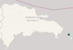
Preliminary Earthquake Report
Magnitude 3.3
Date-Time • 19 Mar 2018 00:02:58 UTC
• 18 Mar 2018 20:02:58 near epicenter
• 18 Mar 2018 20:02:58 standard time in your timezone
Location 18.292N 68.016W
Depth 103 km
Distances • 81 km (50 miles) W (266 degrees) of Rincon, PR
• 81 km (51 miles) W (268 degrees) of Stella, PR
• 82 km (51 miles) ESE (116 degrees) of Higuey, La Altagracia, Dominican Republic
• 102 km (63 miles) E (98 degrees) of La Romana, La Romana, Dominican Republic
• 200 km (124 miles) W (264 degrees) of SAN JUAN, Puerto Rico
Location Uncertainty Horizontal: 2.7 km; Vertical 2.1 km
Parameters Nph = 28; Dmin = 47.5 km; Rmss = 0.42 seconds; Gp = 154°
Version =
Event ID pr 20180780

Preliminary Earthquake Report
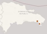
Magnitude 3.1
Date-Time • 21 Mar 2018 04:34:53 UTC
• 21 Mar 2018 00:34:53 near epicenter
• 21 Mar 2018 00:34:53 standard time in your timezone
Location 18.471N 68.944W
Depth 133 km
Distances • 5 km (3 miles) NNE (31 degrees) of La Romana, La Romana, Dominican Republic
• 30 km (18 miles) SW (236 degrees) of Higuey, La Altagracia, Dominican Republic
• 35 km (22 miles) SSE (163 degrees) of El Seybo, El Seybo, Dominican Republic
• 106 km (66 miles) E (92 degrees) of SANTO DOMINGO, Dominican Republic
Location Uncertainty Horizontal: 6.3 km; Vertical 1.9 km
Parameters Nph = 16; Dmin = 62.8 km; Rmss = 0.31 seconds; Gp = 203°
Version =
Event ID pr 20180800

Preliminary Earthquake Report
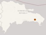
Magnitude 4.1
Date-Time • 23 Mar 2018 07:41:21 UTC
• 23 Mar 2018 03:41:21 near epicenter
• 23 Mar 2018 03:41:21 standard time in your timezone
Location 18.548N 69.085W
Depth 112 km
Distances • 18 km (11 miles) NW (317 degrees) of La Romana, La Romana, Dominican Republic
• 23 km (14 miles) E (93 degrees) of Consuelo, San Pedro de Macoris, Dominican Republic
• 25 km (16 miles) S (191 degrees) of El Seybo, El Seybo, Dominican Republic
• 91 km (57 miles) E (87 degrees) of SANTO DOMINGO, Dominican Republic
Location Uncertainty Horizontal: 8.1 km; Vertical 4.9 km
Parameters Nph = 37; Dmin = 74.4 km; Rmss = 0.85 seconds; Gp = 89°
Version =
Event ID us 1000d7v3

Preliminary Earthquake Report
Magnitude 3.6
Date-Time • 24 Mar 2018 05:58:17 UTC
• 24 Mar 2018 01:58:17 near epicenter
• 24 Mar 2018 01:58:17 standard time in your timezone
Location 19.224N 68.784W
Depth 10 km
Distances • 57 km (36 miles) E (88 degrees) of Samana, Samana, Dominican Republic
• 57 km (36 miles) NNE (28 degrees) of El Seybo, El Seybo, Dominican Republic
• 68 km (42 miles) N (353 degrees) of Higuey, La Altagracia, Dominican Republic
• 90 km (56 miles) NNE (12 degrees) of La Romana, La Romana, Dominican Republic
• 147 km (91 miles) ENE (57 degrees) of SANTO DOMINGO, Dominican Republic
Location Uncertainty Horizontal: 3.1 km; Vertical 2.5 km
Parameters Nph = 31; Dmin = 90.8 km; Rmss = 0.83 seconds; Gp = 239°
Version =
Event ID pr 20180830
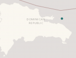

Preliminary Earthquake Report
Magnitude 2.0
Date-Time • 29 Mar 2018 07:41:49 UTC
• 29 Mar 2018 03:41:49 near epicenter
• 29 Mar 2018 03:41:49 standard time in your timezone
Location 18.991N 68.066W
Depth 19 km
Distances • 79 km (49 miles) ENE (59 degrees) of Higuey, La Altagracia, Dominican Republic
• 105 km (66 miles) ENE (76 degrees) of El Seybo, El Seybo, Dominican Republic
• 112 km (70 miles) NW (310 degrees) of Rincon, PR
• 114 km (71 miles) ENE (57 degrees) of La Romana, La Romana, Dominican Republic
• 206 km (128 miles) ENE (74 degrees) of SANTO DOMINGO, Dominican Republic
Location Uncertainty Horizontal: 3.4 km; Vertical 9.1 km
Parameters Nph = 7; Dmin = 63.6 km; Rmss = 0.50 seconds; Gp = 217°
Version =
Event ID pr 20180880
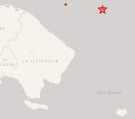

Preliminary Earthquake Report
Magnitude 3.0
Date-Time • 30 Mar 2018 02:21:52 UTC
• 29 Mar 2018 22:21:52 near epicenter
• 29 Mar 2018 22:21:52 standard time in your timezone
Location 18.043N 68.151W
Depth 55 km
Distances • 87 km (54 miles) SE (137 degrees) of Higuey, La Altagracia, Dominican Republic
• 97 km (60 miles) ESE (116 degrees) of La Romana, La Romana, Dominican Republic
• 101 km (62 miles) WSW (251 degrees) of Rincon, PR
• 197 km (122 miles) ESE (105 degrees) of SANTO DOMINGO, Dominican Republic
Location Uncertainty Horizontal: 1.6 km; Vertical 2.6 km
Parameters Nph = 14; Dmin = 115.9 km; Rmss = 0.22 seconds; Gp = 192°
Version =
Event ID pr 20180890
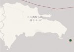

Cpt - Gringo,
A lot of very shallow earthquakes today - in the Mona Channel. Usually they are 100 Km plus deep. These were 10 to 20 Km deep. Any thought on this Cpt-Gringo ?
Olly and the team
Source Info USGS
Along the line and extended line of the Mona Canyon it appears (which is pulling itself wider).
https://earthquake.usgs.gov/earthqu...Modes":["list","map"],"event":"pr2018093006"}
Historically there have been two big earthquakes close to either end 7.3, 1918 and 7.5, 1943.
Last edited:
The last 7 months or so has seen a significant uptick in slippage along the fault running to the north of the DR past PR. This may be having some secondary effects on the rift zone in the Mona Passage.
The rift zone between the two big islands in the Mona Passage is normally fairly active with frequent small tremors. Usually, not this many in this short span of time though. Clearly, the seafloor in this region is currently undergoing a period of sustained shifting.
Two ways of looking at it:
1) Lots of little pressure releases means pressure is being dissipated regularly and a big quake is less likely.
2) The pressure in this rift zone has built up during less active periods and the rift zone is no longer able to sustain increased build up. These frequent small releases could be akin to cracks appearing in glass before it shatters.
By far the biggest concern for the DR in this part of the Atlantic is the major strike-slip-fault north of the island. The rift zone in the passage can produce significant shakes (5 & 6, maybe a 6.8) with the potential for a quick landing tsunami at anytime. Generally, however, the activity in the rift zone occurs at significant depth producing only a shake hazard. It is worth watching the any trends that suggest the average depth of successive tremors are rising towards the seabed.
We do not have a way to measure the pressure that builds up in these areas and no way to ascertain whether any specific tremor takes away from or adds additional pressure within the rift. It is not particularly accurate to say a significant increase in small quakes is a prelude to a large one, but one can say that frequent small quakes indicate an increase in overall crust movement and that can mean that a large quake is more likely to occur than it would be during a period of lesser activity.
People who live within 2 km of the coast and at an altitude of less than 250 feet need a plan to get up high quickly. Threatening waves could arrive within about 15-30 minutes along any coast in the DR. In this country, significant shaking is going to knock all sorts of things and parts of things down. From coconuts to power lines to concrete and glass. Not drowning and not getting bonked on the head are the two big immediate worries.
For now we watch and wait, hoping option #1 is in play.
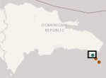
Preliminary Earthquake Report
Magnitude 2.5
Date-Time • 5 Apr 2018 00:39:04 UTC
• 4 Apr 2018 20:39:04 near epicenter
• 4 Apr 2018 20:39:04 standard time in your timezone
Location 18.220N 68.689W
Depth 89 km
Distances • 38 km (24 miles) SE (128 degrees) of La Romana, La Romana, Dominican Republic
• 45 km (28 miles) S (177 degrees) of Hig�ey, La Altagracia, Dominican Republic
• 71 km (44 miles) ESE (112 degrees) of San Pedro de Macoris, San Pedro de Macoris, Dominican Republic
• 137 km (85 miles) ESE (103 degrees) of SANTO DOMINGO, Dominican Republic
Location Uncertainty Horizontal: 14.3 km; Vertical 3.3 km
Parameters Nph = 11; Dmin = 47.4 km; Rmss = 0.37 seconds; Gp = 209°
Version =
Event ID pr 20180950

Haiti
M4.0 - HAITI REGION
Preliminary Earthquake Report
Magnitude 4.0
Date-Time • 12 Apr 2018 00:45:51 UTC
• 11 Apr 2018 19:45:51 near epicenter
• 11 Apr 2018 20:45:51 standard time in your timezone
Location 19.712N 73.099W
Depth 10 km
Distances • 37 km (23 miles) SW (227 degrees) of Port-de-Paix, Nord-Ouest, Haiti
• 52 km (32 miles) NW (304 degrees) of Gona�ves, Artibonite, Haiti
• 70 km (44 miles) NW (312 degrees) of Desdunes, Artibonite, Haiti
• 86 km (53 miles) W (265 degrees) of Cap-Haitien, Haiti
• 152 km (95 miles) NNW (328 degrees) of PORT-AU-PRINCE, Haiti
Location Uncertainty Horizontal: 4.3 km; Vertical 1.4 km
Parameters Nph = 32; Dmin = 156.1 km; Rmss = 1.05 seconds; Gp = 57°
Version =
Event ID us 2000dyja

Preliminary Earthquake Report
Magnitude 2.8
Date-Time • 12 Apr 2018 02:00:02 UTC
• 11 Apr 2018 22:00:02 near epicenter
• 11 Apr 2018 22:00:02 standard time in your timezone
Location 19.257N 68.036W
Depth 61 km
Distances • 100 km (62 miles) NE (45 degrees) of Higuey, La Altagracia, Dominican Republic
• 119 km (74 miles) ENE (63 degrees) of El Seybo, El Seybo, Dominican Republic
• 130 km (81 miles) NW (315 degrees) of Aguadilla, PR
• 135 km (84 miles) NE (47 degrees) of La Romana, La Romana, Dominican Republic
• 218 km (135 miles) WNW (294 degrees) of SAN JUAN, Puerto Rico
Location Uncertainty Horizontal: 3.6 km; Vertical 10.3 km
Parameters Nph = 33; Dmin = 91.1 km; Rmss = 0.73 seconds; Gp = 221°
Version =
Event ID pr 20181020

Preliminary Earthquake Report
Magnitude 3.7
Date-Time • 16 Apr 2018 00:42:08 UTC
• 15 Apr 2018 20:42:08 near epicenter
• 15 Apr 2018 20:42:08 standard time in your timezone
Location 18.548N 68.867W
Depth 116 km
Distances • 17 km (11 miles) NE (40 degrees) of La Romana, La Romana, Dominican Republic
• 18 km (12 miles) WSW (244 degrees) of Higuey, La Altagracia, Dominican Republic
• 31 km (19 miles) SE (144 degrees) of El Seybo, El Seybo, Dominican Republic
• 114 km (71 miles) E (87 degrees) of SANTO DOMINGO, Dominican Republic
Location Uncertainty Horizontal: 1.1 km; Vertical 1.1 km
Parameters Nph = 22; Dmin = 117.1 km; Rmss = 0.31 seconds; Gp = 113°
Version =
Event ID pr 20181060
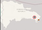

Preliminary Earthquake Report
Magnitude 3.2
Date-Time • 19 Apr 2018 07:48:24 UTC
• 19 Apr 2018 03:48:24 near epicenter
• 19 Apr 2018 03:48:24 standard time in your timezone
Location 18.341N 68.369W
Depth 108 km
Distances • 47 km (30 miles) SE (131 degrees) of Higuey, La Altagracia, Dominican Republic
• 64 km (40 miles) E (99 degrees) of La Romana, La Romana, Dominican Republic
• 85 km (53 miles) SE (124 degrees) of El Seybo, El Seybo, Dominican Republic
• 168 km (104 miles) E (96 degrees) of SANTO DOMINGO, Dominican Republic
Location Uncertainty Horizontal: 4.2 km; Vertical 2.8 km
Parameters Nph = 13; Dmin = 144.9 km; Rmss = 0.47 seconds; Gp = 144°
Version =
Event ID pr 20181090 ***This event has been revised.


