
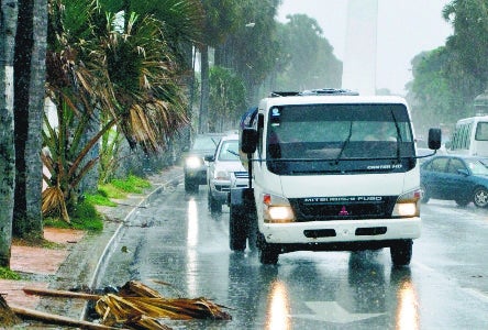
A low pressure and trough is forecast to bring significant downpours, thunderstorms on Wednesday and Thursday (18 and 19 September) to most of the southern Caribbean Sea coastline. The storm has formed south of the Dominican Republic, reported the National Meteorological Office (Onamet).
The Center for Emergency Operations has issued a green alert for 16 provinces. to possible flooding in the provinces of Santiago, Hato Mayor, Monte Plata, La Vega, Monseñor Nouel (Bonao), San Cristóbal, La Altagracia, San Pedro de Macorís, La Romana, El Seibo, Peravia, San José de Ocoa, Azua, Barahona, Pedernales and Greater Santo Domingo.
The heavy rains could continue through Friday and Saturday, as it is moving slowly.
The National Hurricane Center of the United States reported on Thursday, 19 September 2019 in the early morning: “A large area of disorganized showers and thunderstorms near and to the southeast of the Dominican Republic is associated with a tropical wave. While upper-level winds are not forecast to be conducive for significant development, locally heavy rainfall is possible over portions of the Dominican Republic and Haiti during the next couple of days. The disturbance is forecast to move slowly northwestward through the weekend.”
The rains are welcome. The Dominican Republic has been suffering the effects of a drought through most of 2019.
NHC reports indicate that Hurricane Jerry is most likely to pass well north of the Dominican Republic over the weekend.
Read more:
Onamet
DR1 Hurricane Season 2019
19 September 2019