
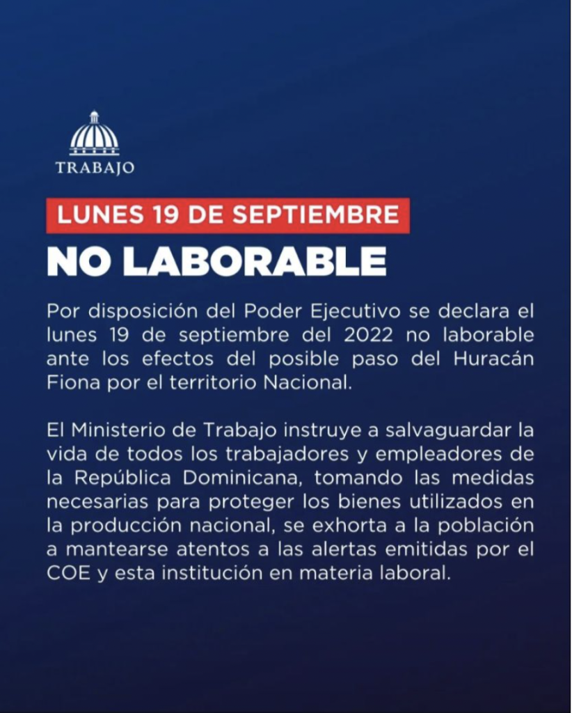
President Luis Abinader ordered early on Sunday that Monday, 19 September 2022 be a non-working day in the Dominican Republic. Schools and universities had already announced they would take two days off in prevention after it was announced that Hurricane Fiona would be affecting the country on Monday, 19 September 2022.
Eastern provinces are pummeled by intense rains and winds as Hurricane Fiona, Category 1, hugs the Dominican Republic bordering the eastern coastline. The COE reports that Fiona made landfall in eastern La Altagracia province at 3:30am on Monday, 19 September 2022. The storm is expected to leave via Samana at around 2pm today.
The Weather Office (Onamet) issued the statement: At 7am today, Hurricane Fiona was located near latitude 18.6 north and longitude 68.8 west, about 40 km west/northwest of Punta Cana and 30 km northeast of La Romana, with maximum sustained winds of 150 kph with higher gusts. Hurricane-force winds extend about 45 km from its center and storm-force winds extend about 240 km. Fiona is moving northwestward about 13 kph.
“If Fiona continues on the forecasted path, its center will move in the following hours through El Seibo and the northern sector of Hato Mayor, and then probably continue through Samaná.”
Early social media reports are that the people in eastern provinces were not expecting the intensity of the storm, as reported in El Caribe. This is the first hurricane to make landfall in the DR in the past 18 years. The last hurricane was Hurricane Ivan in 2004.
The importance of the Dominican Republic government having its own integral radar system is again apparent as the NHC reports delayed in showing the actual track Hurricane Fiona would take after it left Puerto Rico. The director of the Weather Office (Onamet), Gloria Ceballos says they work closely with the NHC and have the Dominican Civil Aviation Institute doppler radar as a complement.
Instead of the curve to the north reported for hours by the NHC as the forecasted path for Fiona, the storm would dip southwest to then start the curve up northwards only once it hugged the Dominican eastern coastline.
The Punta Cana International Airport does have its own radar with a radio de 300 kilometers.
The bad news is that the storm is moving slow 8mph or around 13kph, and that it did not turn to the north as almost all the international weather sites was forecasting, leading to certain complacency locally.
Early videos shared on social media showed the same intensity of the winds and rains battering through Punta Cana as those that were circulating showing Puerto Rico. Usually, what happens in Puerto Rico is a trailer of what the storms will bring to the DR.
The storm has brought torrential rains and flooding to eastern provinces. But the capital city, Greater Santo Domingo, has been spared.
The Center for Emergency Operations in its Monday, 19 September 2022 morning bulletin indicates that 13 provinces are on red alert, including Greater Santo Domingo and Punta Cana, and 18 on yellow (watch) alert with the threat of heavy downpours, thunderstorms and wind gusts. Flooding of rivers, streams, creeks and urban flooding is expected.
The red alert is issued for: Greater Santo Domingo and the provinces of San Cristobal, San Pedro de Macorís and Monte Plata in the south central; La Romana, La Altagracia in the southeast; María Trinidad Sánchez (Nagua), Duarte (San Francisco de Macorís and Bajo Yuna River area), Espaillat, Puerto Plata, Samaná in the northeast; Hato Mayor, El Seibo in the east.
Provinces on yellow alert are: In the northeast Sanchez Ramirez (Cotui); in the southwest Azua, San Juan de la Maguana, Barahona, Pedernales and Bahoruco; In the southcentral, Peravia (Baní) and San José de Ocoa; in the center of the country, Monseñor Nouel (Bonao), Hermanas Mirabal (Salcedo), La Vega, Santiago; in the center, on the border with Haiti Elías Piña; in the northwest Montecristi, Santiago Rodríguez, Valverde and Dajabón.
The Ministry of Tourism issued a ban on the use of beaches and water sports on all the coasts of the country, as well as all recreational activities in the mountains and the use of spas in rivers, pools, canals and streams. All boats in the coastal perimeter of the country must remain in port.
Follow the storm:
Center for Emergency Operations
Listin Diario
El Dia
El Caribe
Hoy
Diario Libre
Diario Libre
DR1 Forums
NHC
Tropical Storm Risk
19 September 2022