- Thread starter MikeFisher
- Start date
You are using an out of date browser. It may not display this or other websites correctly.
You should upgrade or use an alternative browser.
You should upgrade or use an alternative browser.
2018 Hurricane Season
dv8
I expect the local papers and news outlets will be the best source of precise weather impact for the Carolinas
https://forecast.weather.gov/MapClick.php?zoneid=NCZ082
might help here
I expect the local papers and news outlets will be the best source of precise weather impact for the Carolinas
https://forecast.weather.gov/MapClick.php?zoneid=NCZ082
might help here
Just issued a mandatory evac for all of my county here in NC. First time ever. Gonna get nasty
SC, NC and Virginia are sure in for a wild ride, a historical one.
"Luckily" Florence is not riding on the highest tides of the year as TS Sandy did,
but Florence is a real Mayor Tropical Cyclone and will blow around more than double/close to tripple the windforce.
surf-forecast web-site is currently reporting important swell end of week ,beginning of the following week. People living close from the beach may want to use it to see what is forecasted for their area.
For people at Encuentro http://www.surf-forecast.com/breaks/Encuentro/forecasts/latest/six_day
I am not an expert but this web-site was quite good in predicting in the past.
What do you think Mike about what is currently forecasted ?
looks all smooth for the Amber Coast.
Friday will be the roughest day in case of Waves, just 1.8 meters and 11 seconds long rolling,
thats perfect Surfer Conditions.
the same for over here in PC/East, Friday will show the highest Surf but also nothing spectacular.
along the South Shores of PR and DR Sea can reach 12ft on 11-13 seconds long rolling Sea,
that is nothing that could bother my filled coffee cup in the cockpit.
wave heights for directly off Punta Cana, specially the southern tip here off Cap Cana, are hard to predict.
it should be awaited well less than the south shores, maybe not even exceeding 8ft and that on long comfy periods,
but we have the Mona Channel at the doorstep, it can be like a water pipe and that pipe gets extra movement from Florence on our North and from Isaac on our South.
so all is possible. the different waves could equalize their powers and flatten down the Ocean for many hours,
also the pressure on the pipe could get too big and add up a lot on the wave level for hours.
you can't tell such precisely for a location that close to a channel when 2 different storms influence the conditions over hundreds of miles wide areas each.
i don't think we will see more than a top of 10ft waves rolling on 10-12 seconds near the Cape.
we have such wave height with well lower periods running much rougher every winter, when some strong breeze blow's from the NE'erly directions onshore for days.
Isaac is running a very small windfield, it does still barely reach north of the 15thN.
the Storm should be located 1 Degree further North when passing south of the Mona Channel,
so with a windfield of the actual size we will not get anything to write home about.
clouds will move through and bring some rain to certain areas, but by now i dont see any waterloads coming our way.
we will get exact water amounts when it passed over the Antilles, but moving as far south as constantly predicted, there will not be any dangerous amounts of anything reaching our soil.
sure the south coast will get wave action hitting the beaches and taking some portions of sand away, but that's what mother nature does all year around once in a while when the Ocean gets moving on it's cycles.
there are no changes to report about Florence.
this is the Big One of 2018 and will get a top ranking if not the #1 Ranking on the records of this Millennium so far.
living in SC or NC within 100 miles of the Ocean I guess I would get packed and spend a long relaxed weekend in South Florida, Florence will have a huge impact on a very wide area/coastline miles.
aside of the powerful Storm Surge banging the coastline of the Carolinas and mid Atlantic Coast, Florence will bring immense water loads not just to the coast but also for record freshwater flooding well Inland.
danger to receive dangerous storm winds is within possibilities up and in to West Virginia.
a huge well organized machine as Florence will very sure slow down on approach.
how much it slows down will be a key factor for damages, the slower the approach the higher the amounts of water to receive and the longer and more powerful the hours of storm surge pounding the coast.
a slow down can result in "weakening", BUT dont mistake that with "relief".
loosing some windpower during the last hours of approach due a slow down means to get the much more dangerous higher amounts of rainloads and longer and stronger storm surge battering the coast.
and even calculating in a power loss on a slow down, it is very likely that Florence still will be a Cat3/Mayor Hurricane power at the moment of touch down.
Helene is not worth to be mentioned, it is just watched with half an eye, just in case.
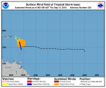
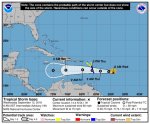
here is the small windfield of Isaac from today's early morning report, i think that was at 5AM.
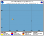
here is the huge windfield of Florence from this morning's late update at 8AM
take that Dot and place it over the Map on the Hit point, that's quiet a wide area covered under it.
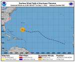
sad times for our friends in the path of Florence, I hope all can get ready or out and stay safe.
as for us Islanders down here, life will continue as usual without dangers around so far.
we are on our calmest Season ever and have just less than 2 more weeks to go before the time is up for big danger forming up out off the far East.
nothing new on the Storm front, all going it's way so far.
Florence has the Landing gear out, the Storm is positioned and will be on a straight line from now towards the Carolinas.
if shown heading once in a while looks "changed", that's only due the normal little bit of Zick Zack, as such big thing can not circle around and go on a straight line the same time.
but there will not be any changes on the Heading, it is a straight runner WNW, Touchdown estimated for early Friday.
the hit time can be delayed if the Storm slows down more than awaited on approach.
as Florence replaced it's collapsed eyewall it showed lower windspeed, but is already back on the 140mphr and as the new eyewall is always built from a wider radius thunderstorm band, the windfield of Florence will show significantly wider and spread out the storm force winds over a well wider area.
prior to the replacement Florence's TS Force reached just 150 miles out of the center.
in the morning we will see the size of the final construction.
the Storm is very well organized and should stay on it's intensification process til Thursday.
the Ocean's surface waters are perfectly hot and reach into depths.
then, closing in, the Storm will run over shallower waters which will show effects. as for the same time windshear forecasts show low-medium 10-15knots of shear it is likely that dry air from the West gets into the transmission,
so on approach we should see Florence as a Cat3 Cyclone on about 120mphr winds.
the biggest danger lies in the Slow Down, more and more some models show the Storm even completely stalling out for a couple days right before or right over the Coast. this would be the worst waterload threat which hopefully will not happen to the extreme of a stalled Hurricane over a Coastal Area.
while the Heading and intensification Power models run in full agreements,
the slow down or stalling is the big uncertainty of this Storm's Landfall and the to be awaited water damage.
as the Carolinas already had a extraordinary wet summer this year, grounds are saturated prior to the Storm's arrival.
the highest storm surge happens at the point where the Right Eyewall hit's Shore.
if the new size of Florence reaches the expected size, then the North Carolina Shore could get 15-20ft of powers rolling in from the Right Eyewall hitpoint 100 miles up the coastline.
the 5ft difference of the estimation comes simply from the fact that the natural Tide in that area has a 5ft difference between Low Tide and High Tide. so the timing makes such huge difference.
the maximum storm surge would happen when the eyewall hit's shore within one hour prior or after the natural High Tide.
the strong mid Atlantic High, which hindered that Florence turned away and will do so til well after Landfall,
is at the same time the big relief for the Caribbean around our soil, as it keeps Isaac on a almost straight Westward Tracking without any Turns to the north anywhere near our Island.
running a tad bit below the 15thN still, Isaac should not manage to reach the 16thN as long as near Hispañola.
as the High stays stable and very strong, the Haitian Peninsula will stay unharmed and even Jamaica should get spared completely, with Isaac running westwards for an other 4 days from now(a longer outlook on that influence is actually not available, but by then it will be already somewhere S-SW of Jamaica).
the powers of Isaac are carried on its E and NorthEast.
awaited storm surge from the fairly small Storm should stay below 4ft once in the caribbean sea, and not exceeding any far out from the storm.
so far so good for us Islanders.
all the best for the Carolinas, in hope that Florence will not stall out for 2-3 days near the coast, where a part of the hurricane still over water would continue to fuel the Storm to stay "alive" for so long even stalled at the same place.
Dark days ahead for the Carolinas.
while windshear West and around Florence is a solid 20Knots now and dry air been injected to the SW side,
the machine proof's solid, no transmission damage awaited.
this fairly small sized Storm contains now a incredibly Big Windflield and loosing Wind Force Powers does not take away the slightest bit of Danger brought in by Florence.
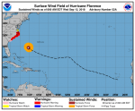
it should arrive Thursday night midnight-3PM Friday morning right off the shores of Southern North Carolina as a weak Cat3/border to Cat2 Cyclone and slow down more or STALL there, moving than slowly WSW'wards along the shores before landing after a 24-48hrs of Battering the area with Hurricane Force Winds plus a incredibly wide area with TS Force, dumping down rainloads which could reach 3FEET of water at the nearest areas(times of measuring rainfall in Inches may be over after this one) and the already high and destructive awaited Storm Surge could result on such slow moving of such powers in over 40ft of Waves battering a coast which will not be anymore after such treatment, for a period of 2-3 DAYS!
such Wave Powers over such lengthy time will dig New Channels between the Barrier Islands there
The actual coastal border region of the Carolinas will not be anymore, it will be new a Extension of the Ocean, to dry that out again will take a very long time.
from Thursday Night til Early Saturday Florence is expected to not move more than just a few miles of an area, while located right in front of the southern NC Shore.
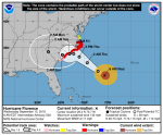
the only good news of the day is that TS Isaac does not show any changes,
aside of the positively up Windshear on it's West which should hinder that it get's Hurricane Satus before it's walk over the Antilles, so Isaac should stay down on just TS Force all the time til way after it passed us safely far south of DR.
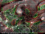
while windshear West and around Florence is a solid 20Knots now and dry air been injected to the SW side,
the machine proof's solid, no transmission damage awaited.
this fairly small sized Storm contains now a incredibly Big Windflield and loosing Wind Force Powers does not take away the slightest bit of Danger brought in by Florence.

it should arrive Thursday night midnight-3PM Friday morning right off the shores of Southern North Carolina as a weak Cat3/border to Cat2 Cyclone and slow down more or STALL there, moving than slowly WSW'wards along the shores before landing after a 24-48hrs of Battering the area with Hurricane Force Winds plus a incredibly wide area with TS Force, dumping down rainloads which could reach 3FEET of water at the nearest areas(times of measuring rainfall in Inches may be over after this one) and the already high and destructive awaited Storm Surge could result on such slow moving of such powers in over 40ft of Waves battering a coast which will not be anymore after such treatment, for a period of 2-3 DAYS!
such Wave Powers over such lengthy time will dig New Channels between the Barrier Islands there
The actual coastal border region of the Carolinas will not be anymore, it will be new a Extension of the Ocean, to dry that out again will take a very long time.
from Thursday Night til Early Saturday Florence is expected to not move more than just a few miles of an area, while located right in front of the southern NC Shore.

the only good news of the day is that TS Isaac does not show any changes,
aside of the positively up Windshear on it's West which should hinder that it get's Hurricane Satus before it's walk over the Antilles, so Isaac should stay down on just TS Force all the time til way after it passed us safely far south of DR.


If you have ever been to the area....
you know it's low.... it will offer little to no resistance to the waves
Hand me a snorkel !!
you know it's low.... it will offer little to no resistance to the waves
Hand me a snorkel !!
If you have ever been to the area....
you know it's low.... it will offer little to no resistance to the waves
Hand me a snorkel !!
yes, that's why it is awaited that Mother Nature will take it Deep Inland.
and of course there are those who are in the path of a major devastating hurricane and do not even know it... the hunters had to do a search and rescue on the way back from the storm for a sailboat that was in the path of Florence and wasn’t aware... they go out to see and don't even check the weather????


The surge will be horrendous, Florence has created waves up to 80 feet is this is correct! :ermm:

thats correct
and of course there are those who are in the path of a major devastating hurricane and do not even know it... the hunters had to do a search and rescue on the way back from the storm for a sailboat that was in the path of Florence and wasn’t aware... they go out to see and don't even check the weather????

there are stupid Fidiots to be found just everywhere.

Getting a bit crowded out there, eh?
yea, specially as there is number 5 awaited very soon in the Gulf of Mexico, lol.
did anybody say this would be a boring Season?
it may be extremely short, but the buggers use their short time window well.
and Isaac, even shown on teh same maximum windspeed of 60mphr,
is weakening, shown on it's rising central pressure of 1003mb now.
it is on the way to become almost a Tropical Depression.
I don't like that too much, it would move slower and drift more northwards.
this small Storm carries quiet some waters around, don't wanna see them raining down on us
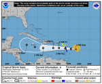
is weakening, shown on it's rising central pressure of 1003mb now.
it is on the way to become almost a Tropical Depression.
I don't like that too much, it would move slower and drift more northwards.
this small Storm carries quiet some waters around, don't wanna see them raining down on us

Isaac, well hit by windshear and not well organized,
carries quiet some water on it's northern quadrants.
http://www.ssd.noaa.gov/PS/TROP/floaters/09L/html5-vis-long.html
carries quiet some water on it's northern quadrants.
http://www.ssd.noaa.gov/PS/TROP/floaters/09L/html5-vis-long.html
both Florence and Isaac run and struggle under highest windshear of 40+Knots.
Florence down on Cat with just 110mphr windpowers.
no mood to do all the stuff all over again now at midnight for a storm not anywhere near our Island.
tomorrow back from the marina i will take a look on the compleetly different arrival power estimations and new set margins for storm surge.
tonight it looks like just a 12hrs landing phase, so the models seem to go away from the significantly slowing down or stalling storm. that would be fantastic news for the Carolinas compared to the prior awaited strong storm battering the coast with hurricane winds for a couple days, if now "only" a Cat1-2 Hurricane would come ashore quickly and speed through.
this would make a immense difference on all danger points like wind damage, storm surge damage and flooding damage.
all cards are newly shuffled with Florence.
Isaac, closing in to the Antilles, down on just 50mphr and rose again an other 2mb to 1006 mb central pressure.
it could go even down to a TD before or while starting landing procedures in the morning.
good morning from again super calm and pure sunny skies at the Cape.

Hurricane Florence, still shown as a Cat2 on110mphr windforce, rose central pressure during last night, up to 956mb now.
it is a smal-mid sized Hurricane in troubles under windshear and finally with dry air in the transmission.
considering its size and low max powers, Florence runs a monster of a big Windfield.
TS Forces are already over the Carolina Shores.
the eye of the storm is expected to make landfall as a Cat1 on South-Central NC-Shores.
by that time the wide windfield will send TS Force Winds up to almost the Virginia border and down to the Georgia border.
Florence could manage to stay a Hurricane Force for 15-20 hrs over Land while wandering WSW into South Carolina.
Hurricane Force Winds should be expected to blow from the Central NC Coast til down to the Central SC Coast and on the track landinward to a 100 miles.
since last evening none of the many models expects Florence to Stall Out prior to landfall,
while the forward speed already went down from formerly 17mphr to now 12mphr, tendency slowing down more.
compared to the expected worst case scenarios, with a Mayor Hurricane stalling right off the shores, the Carolinas got very lucky, as there is no way that Florence could gain powers back, now running shallow waters and already interacting with Land.
BUT, that "Lucky" does not mean Florence would be a no show for the Carolinas, this Storm will bring a heck of waterloads all around and very far Inland.
I am still at the Marina, no time to look on waterload charts, I bet you guys living in the effected areas can look them uo easily via google or your local emergency center's updates.
by far not the awaited big blow, Florence will be one of the most destructive forces that ever hit that region.
Tropical Isaac been nicely in trouble with harsh windshear last evening and during most of the night.
considering such long time frame already under 20-30 Knots of windshear and not been taken down and out completely, show's how high of a heat content/fueling powers the Ocean East of the Caribbean Islands contains.
the same goes for Florence and the Heat Content off the US Coast, during other Seasons with that windshear from last night, it would have been gone down to some rainclouds over night.
on average Temp/Heat Content Years Isaac would have been down to a TD last evening and would not be mentioned anymore today, other than some rainclouds moving into the Caribbean Sea.
located now, touching Land over the Central Antilles, on 15.2N, it looks like it could manage to stay a TS til sunday morning or sunday Noon even. those Storms this Season are very hard headed, tough to knock down.
Steaming straight Westward on over 20mphrs, Isaac should be straight south of the Mona Channel by tomorrow Noon,
maybe mid afternoon awaiting a little slow down due the Touch Down on the Antilles.
Isaac will not reach 16N, should not even come closer than 15.5N.
Isaac's whole southern quadrants are destroyed by windshear, all remaining powers are carried in the northern Quadrants towards Puerto Rico and Hispañola.
as i await it to continue struggling with the windshear, plus bothering interaction with the small Islands on the East,
i think even our south shores should stay safe from TS Force Winds.
but we will get up to 20 knots winds blowing around and some northern rainbands will dump some water over parts of PR and DR. where exactly and how much is hard to estimate, as the Storm is changing/bothered.
2-4 inches of water during the bypass should be a realistic amount for the South and in some Central Regions.
if small strong spread out cells rain down in PR or DR over Land in a mountainous region, such isolated areas could receive 6-8 inches max.
we will get rough Ocean conditions also here on the East tomorrow and til late into Saturday, during Sunday all should calm down and get back to normal quickly.
looks like a easy piece quick come quick go without dangerous conditions, as long as people use their brain and stay away from vulnerable areas in case of strong rain.
here is the Windfield of Isaac from 8AM this morning.
you can see that it has nothing left on its south.
