The NHC is calling for gusty winds and rain for Hispaniola on Friday from that tropical wave that thankfully didn't grow up. Hope there is no flooding. Mike may be able to tell us what the water load may be like.
The Emergency Operations Center (COE) reported this Friday that a tropical wave moves over the central part of the Dominican territory and interacts with a trough that is projected over the southeastern part of the country.
During the development of the night, both phenomena will continue generating cloudy with showers or showers, occasional thunderstorms without ruling out possible gusts of wind over the regions; east, northeast, southeast, central mountain range and the border zone that in some points could extend, even in the early morning, the entity indicated.
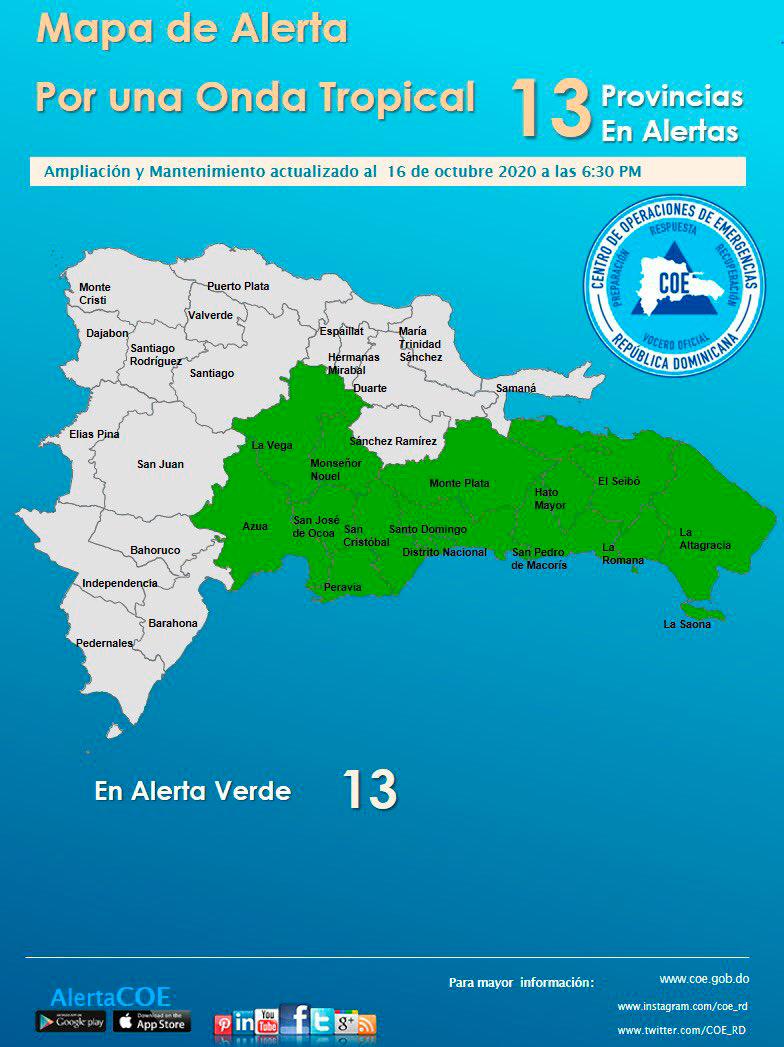
In this sense, the COE issued a green alert level for possible sudden or gradual urban floods, as well as the overflow of rivers, streams and ravines over the Monte Plata, El Seibo, San Cristóbal, Hato Mayor, La Altagracia provinces, Peravia, San Pedro de Macorís, La Romana, Azua, Monsignor Nouel, La Vega, San José de Ocoa, Santo Domingo and the National District.