2024 Hurricane Season

MikeFisher

The Fisherman/Weather Mod
Feb 28, 2006
13,875
2,431
113
Punta Cana/DR
www.mikefisher.fun
Hey, take a pill and chill. "It is what it is'" has got to be one of the dumbest and tritest phrases there is today - typically used by people who really don't know what it is, or lack the verbal acuity to describe it.
Or it is just the FACT and nobody can change what comes along, we just can watch and move with it as it appears,
which makes then this "dumbest and tritest phrase" the only True word about the case.
 

cavok

Silver
Jun 16, 2014
10,276
4,505
113
Cabarete
Or it is just the FACT and nobody can change what comes along, we just can watch and move with it as it appears,
which makes then this "dumbest and tritest phrase" the only True word about the case.
Well, I can tell you, it's about the least insightful, least original thing, you can say. I mean - DUH!!! If you need to use that phrase to sound somehow profound - you're not.

I have no idea what you're reading into my post, but it's in no way intended to "scare" anybody, It's just a simple statement of statistical probabilities. It's not a 100% guarantee that's it's going to happen and when you look at just how big the Atlantic and Caribbean area are, the probability is small even in a busy season. If and when a hurricane is forecast to come our way, that's the time to be more concerned(not scared) and make appropriate preparations.
 

MikeFisher

The Fisherman/Weather Mod
Feb 28, 2006
13,875
2,431
113
Punta Cana/DR
www.mikefisher.fun
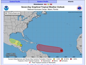
So it is the Start of this time of the year, again.
Here we go with the starting system of the Season for our surroundings.
Chances for development are null, it will move NEwards out on open Atlantic.
Screenshot 2024-05-24 102834.png
 

MikeFisher

The Fisherman/Weather Mod
Feb 28, 2006
13,875
2,431
113
Punta Cana/DR
www.mikefisher.fun
The climate is changing so much, it's hard to believe that at this time of year potential threats already appear.
in the last 30 years, since i watch that stuff, to date i do not see any change of climate.
we had decades before systems and even developed systems/tropical storms earlier than todays date and we had late out of season systems and tropical storms well into december.
nothing of that is related to any kind of human made climate change, which politically seems to be a so important theme todays, but by my own take is nothing more than that, a politically usable thing to drive humanity crazy for nothing and desctract from the real problems we have between us which should be solved on short term.
We will get our next ice age wiping humanity off the planet guaranteed, and til then we will have the ups ad downs of earth's temps, which the planet always had, long before the human species been on this planet, and always will have, even very long after mother nature deleted us from this lil piece of property.
that climate does change, that of course is normal it had it's ups and downs in the past few many millions of years and it will sure continue on those patterns, but nothing of that would have to do anything with the very very little footprint that humanity has and will leave on this planet.
For Us and for Now, our yearly Hurricane Season, all our surroundings and specially all out of our East between the Cabo Verde Islands and the Lesser Antilles, is looking as usual and as expected each season since a longer while.
In case of to be awaited activity,as always, it means nothing to "forecast" 10 or 20 or 30 named storms, the only important thing is when and specially WHERE such systems come up and head to, and exactly those important lil details nobody could predict, we simply have to wait until such is up and running, as tough as it is to not know the slightest thing in advance, but that's the fact we've been thought by our own experience over the last 20+ years observing and reporting about those mother nature's powers.
Until then, smart people, will live Live and have fun and just observe and of course will be prepared/ready in case something strong/dangerous comes on a way towards our home.
Happy Mothers Day Evening.
 

MikeFisher

The Fisherman/Weather Mod
Feb 28, 2006
13,875
2,431
113
Punta Cana/DR
www.mikefisher.fun
Just keeping the topic alive.
What is actually shown on the 7 days outlook is not of danger to us.
Out of our East the atmosphere is Dry and Windshear is very High.
Over our Caribbean Sea also the windshear is very high and the atmosphere dry.
If something pops up, it should happen off our West and NW annd also heading in those directions.
As far as it is possible to look ahead of time, all is fine and no troubles expected.

Screenshot 2024-06-15 213818.png

Screenshot 2024-06-15 214247.png

Screenshot 2024-06-15 214347.png


Happy Weekend Everyone.
 

Drake

Bronze
Jan 1, 2002
669
24
18
So there is a potential CAT 3 passing South or over the DR next Wednesday. Too soon to speculate but season starting to heat up
 

MikeFisher

The Fisherman/Weather Mod
Feb 28, 2006
13,875
2,431
113
Punta Cana/DR
www.mikefisher.fun
Yes, it is the first system of the season on watch, even still far out east.
so far it has a dry air environment to fight ahead and at this moment very high windshear on its way.
without that high windshear, i would already start to get alerted, but lets see how it moves the next 2-3 days, starts development or not.
I still see it as too early to get into something, but we never know.

Screenshot 2024-06-27 152043.png

It is centered above the 10th North, so if it fights the bad conditions, it would get it's spin moving and could become a storm.
It needs some more days to see procedures and then anyways to see a final direction.
At this point, IF it would become a storm, I would place it well South of DR,
BUT all that is early speculations, which need the observation of several days to find out a Line/Improvement etc.
We wil keep an eye on it, sure.
 
  • Like
Reactions: colmcb

MikeFisher

The Fisherman/Weather Mod
Feb 28, 2006
13,875
2,431
113
Punta Cana/DR
www.mikefisher.fun
Screenshot 2024-06-28 100456.png

This is changing quick and def to be watched.
It looks very likely that we will see aa TD within 24hrs and a Storm of unknown powers approaching the Central/Southern Lesser Antilles as early as Sunday evening/no later than Monday afternoon.
Timing and powers are full speculation, still, as it is "in the make" and needs "on site investigation" for details.
On Sat it appears that it moves a powerful section ahead of the Center of the Low, that area should already contain wind force near TS Powers.
Windshaer is heavy but located N of the Low, which is now centered a bit S of the 10th.
It also runs at this moment S of the heaviest Parts of the Dry Air, how much of it get's injected by windshear will make a huge difference on upcoming powers.

June isn't over yet, and we already have to stay tuned for some action watching right at the beginning of July.
 
  • Like
Reactions: colmcb and zoey_kat

MikeFisher

The Fisherman/Weather Mod
Feb 28, 2006
13,875
2,431
113
Punta Cana/DR
www.mikefisher.fun
TD2 is running and a Hurricane is forming out of our East.
The (uncertain) long range tracking will keep it S of DR, which would be perfect for me for our always need of Water up here on the Ranch.
We will bring new seeds out tomorrow and Sunday due the weather outlook, in hope to get some good rainfalls out of it during next week.
Screenshot 2024-06-28 171942.png
 

MikeFisher

The Fisherman/Weather Mod
Feb 28, 2006
13,875
2,431
113
Punta Cana/DR
www.mikefisher.fun
TS Beryl is fueling it's powers and rising, awaited to be a hurricane tomorrow.
Tracking looks unchanged so far, but is still too far out to be taken as accurate for our own Island Area.
Actual positioning of the Atlantic High would bring it very close to our S and walking right over Jamaica, which is on a long range forecast a very dangerous tracking for Us, as just the slightest shift northward by the High Pressure Ridge would let the storm run well higher on the Map.
The 2nd System, running right behind Beryl, looks bothersome, too.
it comes from the same birthplace, will run the same path, but it will have a more favorable path, as Beryl is taking out dry air and lowering windshear, to allow easier intensification, once a storm would be up there.
Beryl is growing powers quickly, from the beginning, despite dry airlayers and strong windshear, so far he eat up both like a lil snack.
Let them stay South there.
 
  • Like
Reactions: colmcb and JD Jones

MikeFisher

The Fisherman/Weather Mod
Feb 28, 2006
13,875
2,431
113
Punta Cana/DR
www.mikefisher.fun
Early in the season, but Hurricane Beryl is the bad boy to fear right away.
Despite high wind shear it is growing powers very quick and we should expect that it continues with that, once reaching the Winward Islands there is no more windshear in its way.
The Windward/Southern Leeward Islands face a Mayor Hurricane of Cat3+ and we just can hope that the actual long range/uncertain forecasted tracking stays true.
It is fueling under high wind shear now, but entering the Caribbean Sea there is no dry air nor any wind shear on the map/on its way, so there are no signs about any downfall of this storm once it entered the Caribbean Sea.
By Monday Noon it should be in the Caribbean Sea and we will see the def tracking, also the power forecasts should by then be very accurate.
By the actual long range outlook, which happened to be well accurate during the last seasons, we will all stay completely fine and the storm will pass in a safe distance south of DR, so no panic necessary, but we have to watch it permanently for any changes.
Where ever such power would do landfall, would be Bad.
We don't care about a few days of rain on/off shitty weather days or some winds, but we have to stay alerted in case the tracking would change towards us.
A Mayor Tracking Factor, the positioning of the high pressure ridges to our North, the known Atlantic High, is looking well in our favor, as at This Moment it does not allow a storm of any powers to turn Northwards/towards DR Soil until it would already have passed West of DR,
but those conditions are a constantly changing/shifting factor, so we have to monitor that permanently until it passed.
In the meanwhile, let's continue to enjoy our sweet Island Life as usual.
It is the time of the year to keep the cars fueled, backup fuel for generator and cars in storage, food that doesn't get damaged within a few days//weeks on stock,
the usual procedures we are used to since decades, to keep life relaxed and worry free even when a bad Biach comes around, just in case.

Cheers
 

chico bill

Silver
May 6, 2016
13,217
6,998
113
The climate is changing so much, it's hard to believe that at this time of year potential threats already appear.
Yes it is changing so much we are almost back to 1966 when there was a major hurricane, Alma in Mexico & Florida, or maybe it is changing so much we are back to 1951 and Hurricane Able which pounded North Carolina in May ! There was also a Cat 3 or 4, Audrey, which landed June 27, 1957.
There are also recorded hurricanes in May & June, before records were so through of one in 1938 which came in January !

So before you swallow the red pill of Climate Change, this is not historically something that is "hard to believe"