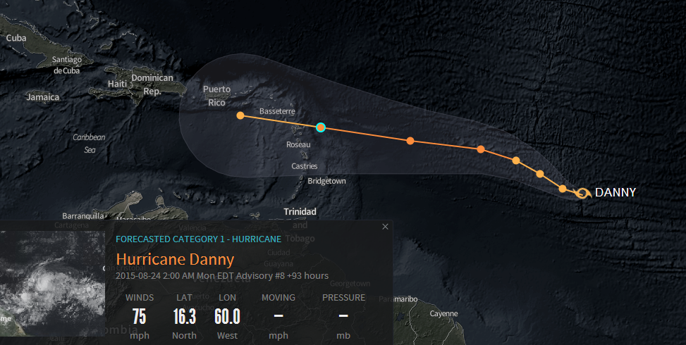
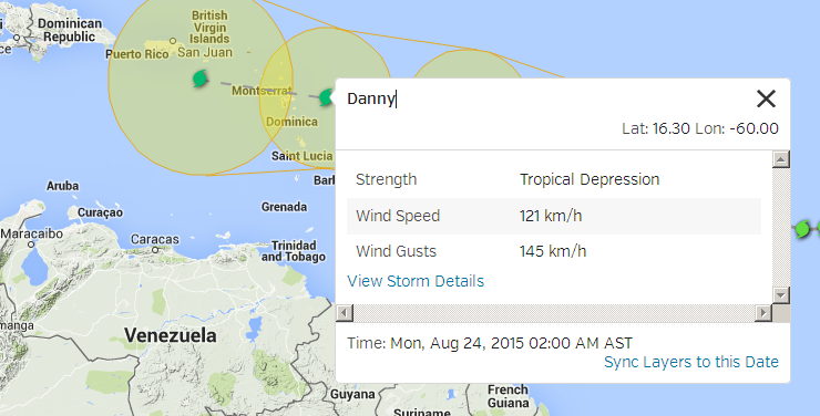
looks sound and nice round today.
it improved a lot from dying down to a much smaller but well spinning center.
let's see how long it lasts on such powers,
that central pressure went down a lot as it intensified a lot and fast due the well smaller size to move.
still struggling as to Where to keep da Eye.
it is not a strong walled of Center, it is a construction site and actually made of poor quality.
looks like DR ingenieurs supervising the construction of haitian labourers, lol.
here you see the eyewall going down, starting a new one 30 minutes ago.
as the storm is small on size, it should not get too much troubles to do so.
that it is troubling on it at all is Goood, as it is a sign of struggles with something,
maybe dry air, windshear looks nice low tho.
the storm should reach it's top powers tomorrow morning, they will stay below 80Knots as the maximum to gain.
he will not hold the max for long, 10hrs, maybe 20 hrs.
by saturday morning the windforce of Danny will already be on a decreasing tendency, after it crossed the 50thW.
sunday morning, by the actual speed running 55-57West, it should be down on the edge to get the downgrade as just a Tropical Storm already, and that's still East of the Islands, doesn't matter it wanders more westwards to enter the caribbean Sea or with a more northerly drift to miss the Islands on the NE completely.
the tracking is very uncertain so far ahead, as it depends on it's size reaching up into the atmosphere, to decide which level of winds will be the more dominating steering winds.
actual direction/steering would let me bet on a pass over the NE'ernmost Islands, with almost zero of any rain for Hispaniola,
but the models tend to bring it more Westwards, wandering into the caribbean Sea. if passing our southern shores close enough we could get rain in PC out of it, MAYBE.
for that tracking lines we need to wait til the weekend, it can change too much from now til then.
my bets are, that there will not be any hurricane named Danny entering caribbean waters or passing our Island anywhere near this season.
to me the storm is a Blender, it looks strong and quick increasing windspeeds since last night, but that's a Fraud, he sized down a lot, and solely due the downsizing he could gain windspeed, that Hurricane-Karma will bite it in da Arse and once it passed it's top powers, the road downwards will be a steep one.
Mike


