2022 Hurricane Season

Status
Not open for further replies.

MikeFisher

The Fisherman/Weather Mod
Feb 28, 2006
13,771
2,206
113
Punta Cana/DR
www.mikefisher.fun
I've got cats and dogs coming down at the moment here in San Cristobal.
has nothing to do with TS Fiona.
We are still not under it's influence, this rain on/off weather we had even here on the east for some evenings/nights, with thunder(ask my dog hiding for hrs in the closet after just a single Thunder in a distance, lol.
This TS keeps looking like passing S of the Mona Passage, and then somewhere after doing it's turn NW.
It is not a strong nor organized system/Storm, but it carries some heavy water loads on it's sides which point towards our Island
and as we know, the Water is the Danger for so many areas.
We will see how it may go down some notches on Winds while approaching, but as usual, we will know such on very short notice,
as no model could predict the changes/moves of such weak thing when it goes over the windward Islands and then may or may not get hit by PR Mountains influence.
This can all change in a heart beat.
The smart thing to do is to prepare for loads of water coming down, if it brings finally less, nothing to complain about.
I personally hope it keeps it's forward speed, or even speeds up, as I have a very nice Saona Island Group booked for monday, can be changed to Tuesday,
but if it comes in/out too slow the waters on the south would still be rough on Tuesday.
Well, that's part of biz anyways, sometimes good, sometimes you have to scratch some income off.
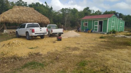
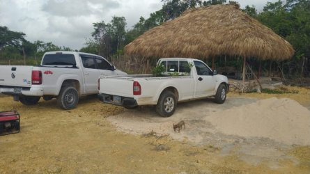
As for the Ranch, this year provided us with much more water than we would have expected for this spring/summer so far,
zero loss of cattle/animals, all is green pastures, plentiful food for all walking meat around.
Fiona will keep it watered, luckily I am not vulnerable to flooding, any waterload would be on it's comfy place within a couple days after any extraordinary rainfall.
We keep watching, as this whole thing can change a lot for this weekend.
Just in case, keep Generators fueled, beer fridges stocked and the girls cooing those good meats,
so long nothing really bad will happen, just a sunday with family at home, watching Netflix, eating and drinking and Life is just Fine.
 

MikeFisher

The Fisherman/Weather Mod
Feb 28, 2006
13,771
2,206
113
Punta Cana/DR
www.mikefisher.fun
btw, to watch TS Fiona and it's water loads Live, use this link here, the Floater watching it from right above.
Keep in mind that each time you click this link, you need to refresh the page then to get the most actual sequence.
It is usual from just an hour ago, the most Live Watch you could get of any system.
 

MiamiDRGuy

Bronze
May 19, 2013
1,400
459
83
I have the 8pm EST updates as follows:

Screenshot 2022-09-16 210907.png


Screenshot 2022-09-16 210913.png
 

MikeFisher

The Fisherman/Weather Mod
Feb 28, 2006
13,771
2,206
113
Punta Cana/DR
www.mikefisher.fun
TS Fiona slowed down and will do it's turn this later afternoon and tonight.
If you took a look on the forecasts online from this morning, simply forget about what was shown there.
It will track NW over western PR, bringing full wind an drain forced to the neighbour Island, the complete neighbour Island.
It could get a knock due the direct impact on PR Mountains, but I do not expect this by now well running system to get destroyed by any means.
It will walk Western Puerto Rico and wander very close NW along the DR East Shores from SE to NE all along the Eastern DR Provinces..
And we are quiet very lucky ducks, staying on the "weak W/SW parts of the Storm.
Be Clear,
we have to expect Tropical Storm Force Winds all along the DR East from La Romana over Cap Cana, Punta Cana, Miches up to Samana.
TS Forces will not extend very far from the Center towards the Western side/our Side, but it will very likely be a Hurricane on the Pass, so it is a very close call to get TS Force or not on our East.
The Storm looks actually declining powers on the forecasts, shown with elevated pressure etc, that is just temporarily, that pressure will show dropped again soon and over all the TS is gaining strength, a Hurricane is what we have to expect.
The full influence of high winds on DR will happen sunday night through monday night, as it will not pass on any high forward speed.
We have to watch this permanently now and stay alert til a hopefully beautiful and for everybody unharmed Tuesday morning.
Our Neighbours in PR are def in for a very bad ride again, all the best for everybody there.
 

MikeFisher

The Fisherman/Weather Mod
Feb 28, 2006
13,771
2,206
113
Punta Cana/DR
www.mikefisher.fun
Here some pictures from this sunny saturday morning of the construction site of my son's new to be place in front of the growing Ranch.
Preparing everything to not let anything fly away too far this weekend.
Nobody is living there, yet, the 2 solar systems for the place i just purchased and they will be mounted in the next weeks while I am out of country.
 

Attachments

  • WhatsApp Image 2022-09-17 at 9.37.23 AM.jpeg
    WhatsApp Image 2022-09-17 at 9.37.23 AM.jpeg
    153.5 KB · Views: 131
  • WhatsApp Image 2022-09-17 at 9.37.24 AM (1).jpeg
    WhatsApp Image 2022-09-17 at 9.37.24 AM (1).jpeg
    182 KB · Views: 155
  • WhatsApp Image 2022-09-17 at 9.37.24 AM (2).jpeg
    WhatsApp Image 2022-09-17 at 9.37.24 AM (2).jpeg
    130.2 KB · Views: 127
  • WhatsApp Image 2022-09-17 at 9.37.24 AM.jpeg
    WhatsApp Image 2022-09-17 at 9.37.24 AM.jpeg
    140.1 KB · Views: 145
  • WhatsApp Image 2022-09-17 at 9.37.25 AM (1).jpeg
    WhatsApp Image 2022-09-17 at 9.37.25 AM (1).jpeg
    159.8 KB · Views: 150
  • WhatsApp Image 2022-09-17 at 9.37.25 AM.jpeg
    WhatsApp Image 2022-09-17 at 9.37.25 AM.jpeg
    125.1 KB · Views: 126

william webster

Platinum
Jan 16, 2009
30,247
4,330
113
Mike, is this thinking right ?


The forecast is for 12 inches or more of rain

Remember that is over a 12-18 period (or more)…hopefully,that eases the flood risk a bit as opposed to buckets full in 2-3 hours.


Fingers crossed
 
  • Like
Reactions: Auryn

MikeFisher

The Fisherman/Weather Mod
Feb 28, 2006
13,771
2,206
113
Punta Cana/DR
www.mikefisher.fun
Turn done.
TS Fiona is tracking WNW.
Very bad for PR, some salvation for DR, it becomes by each our on this tracking less likely taht it's later Hurricane Center will touch Ground in DR.
The closest point will be Cabo Engaño on our Easternmost Top Sunday night and the Easternmost point of the Samana Peninsula Monday Noon-Early afternoon.
This is for DR a big relief of destruction powers wind and water wise alike,
BUT nothing is safe:
We should get our good share of water and we will get all along the East also some strong winds at least chances for both are very high on the scale.
I dont want to imagine what it may leave behind in PR, that really look's very bad at this point.
The Storm is running less than 10mphr forward speed and as a growing storm it is not expected that it will speed up this weekend,
so there will not be a very quick in/out.
Over Land on Western PR, with it's hardest portions all over Puerto Rico's highest elevations, everything is possible.
It could get knocked down by significant pieces, it could bounce away towards any side and change Track,
never ever in history did any model forecast a change of Heading/Powers due the touch of PR Mountains,
so the forecasts will continue to show a WNW Tracking and rising powers until the impact really happened and Satellite observations could tell anything new on tracking/powers etc.
Cattle in. checked.
Generator fueled and test run successful. checked.
Food storage on good levels as usual. checked.
No balcony, veranda, pool furnichure left outside. checked.
Beer Fridge topped to the max. checked.
Stay safe everybody
 

MikeFisher

The Fisherman/Weather Mod
Feb 28, 2006
13,771
2,206
113
Punta Cana/DR
www.mikefisher.fun
This is the official Warnings for the next couple days Path of Fiona from 8:00PM Saturday September 17th 2022.

SUMMARY OF WATCHES AND WARNINGS IN EFFECT:

A Hurricane Warning is in effect for...
* Puerto Rico, including Vieques and Culebra

A Hurricane Watch is in effect for...
* U.S. Virgin Islands
* South coast of the Dominican Republic from Cabo Engano westward to
Cabo Caucedo
* North coast of the Dominican Republic from Cabo Engano westward to
Puerto Plata

A Tropical Storm Warning is in effect for
...
* U.S. Virgin Islands
* British Virgin Islands
* South coast of the Dominican Republic from Cabo Engano westward to
Cabo Caucedo
* North coast of the Dominican Republic from Cabo Engano westward to
Puerto Plata

A Tropical Storm Watch is in effect for...
* South coast of the Dominican Republic west of Cabo Caucedo to
Barahona


DISCUSSION AND OUTLOOK
----------------------
At 800 PM AST (0000 UTC), the center of Tropical Storm Fiona was
located near latitude 16.6 North, longitude 64.9 West. Fiona is
moving toward generally the west-northwest near 8 mph (15 km/h),
and this motion is expected to continue through tonight. A
northwestward motion is forecast to begin on Sunday and continue
through Tuesday. On the forecast track, the center of Fiona will
move south of the U.S. Virgin Islands this evening, approach Puerto
Rico tonight, and move across Puerto Rico by Sunday afternoon.
Fiona will then offshore of the Dominican Republic on Monday and
near or to the east of the Turks and Caicos Islands on Tuesday.

Maximum sustained winds are near 60 mph (95 km/h) with higher
gusts. Strengthening is forecast, and Fiona is expected to become a
hurricane before reaching the southern coast of Puerto Rico on
Sunday. Additional strengthening is expected on Monday and Tuesday
while Fiona moves over the southwestern Atlantic.

Tropical-storm-force winds extend outward up to 140 miles (220 km)
from the center. A station at Teagues Bay, St. Croix, recently
reported a gust to 45 mph (72 km/h).

The minimum central pressure estimated from Air Force Reserve
Hurricane Hunter aircraft data is 998 mb (29.47 inches).


HAZARDS AFFECTING LAND
----------------------
Key messages for Tropical Storm Fiona can be found in the Tropical
Cyclone Discussion under AWIPS header MIATCDAT2 and WMO header
WTNT42 KNHC and on the web at hurricanes.gov/text/MIATCDAT2.shtml.

WIND: Hurricane conditions are expected on Puerto Rico Sunday and
are possible in the U.S. Virgin Islands tonight. Hurricane
conditions are possible within the hurricane watch area in the
Dominican Republic Sunday night and Monday.


Tropical storm conditions will continue across portions of the
Leeward Islands within the warning area through this evening.
Tropical storm conditions are beginning to reach the U.S. and
British Virgin Islands, and will spread westward across Puerto Rico
this evening and tonight and portions of the Dominican
Republic late Sunday. Tropical storm conditions are possible across
the watch area in the Dominican Republic Sunday night.


RAINFALL: Fiona is forecast to produce the following rainfall:

Leeward Islands and Northern Windward Islands: Additional 2 to 4
inches.

British and U.S. Virgin Islands: 4 to 6 inches with local maximum of
10 inches possible.

Puerto Rico: 12 to 16 inches with local maximum of 20 inches
possible, particularly across eastern and southern Puerto Rico.

Dominican Republic: 4 to 8 inches with local maximum of 12 inches
possible, particularly on the far eastern coast.


Haiti: 1 to 3 inches with isolated maximum totals of 4 inches.

Turks and Caicos: 4 to 6 inches.
 
  • Like
Reactions: Auryn

reilleyp

Well-known member
Dec 12, 2006
1,203
677
113
Here some pictures from this sunny saturday morning of the construction site of my son's new to be place in front of the growing Ranch.
Preparing everything to not let anything fly away too far this weekend.
Nobody is living there, yet, the 2 solar systems for the place i just purchased and they will be mounted in the next weeks while I am out of country.
Where will you mount the solar panels?
 

MikeFisher

The Fisherman/Weather Mod
Feb 28, 2006
13,771
2,206
113
Punta Cana/DR
www.mikefisher.fun
Yes
its active now… no word from the FisherMan….. but there’s chatter
whats the link or number for it?
I think i left it when it was full of chit chat when we had no storms, phone bieping permanently day and night.
Anyways, as long as DR1 is not going down, so long it is way more convenient to report here on the topic.
 

MikeFisher

The Fisherman/Weather Mod
Feb 28, 2006
13,771
2,206
113
Punta Cana/DR
www.mikefisher.fun
Fiona will be a Hurricane any moment, the powers are there.
over night so far zero change on tracking, as awaited the storm is dropping pressure and growing powers.
PR is already for most part under TS Force Winds and they will feel near Hurricane or by then Hurricane Force winds in just a little bit.
Most TS forces extend from the Center out towards the N, NE, E and SE of the Center the farest, also a good chunk towards the NW.
The near Hurricane Force winds and higher forces extend only off the Center to the NE.
The Storm will touch the SW Corner of PR the next hours and by this moment looks like it will continue it's WNW Tracking.
That means for us here in DR, specially the East Shores:
We will have a 80-85mphrs Hurricane Centered right off the Cape/Cabo Engaño to see the phenomenom with the own eyes tonight somewhere Midnight/3:00AM.
The Storm should continue it's slow pace WNW-NW,
so we will have TS Force winds right over or at least just some very few miles away for a minimum 10/15hrs and that could also extend easily to 15hrs.
It will reach us first with it's NW Quadrant, then it should go calmer as we will be on the weak W and SW Quadrants where strong winds do not reach out far from the Center, and once it passed our area towards WNW/NW from Punta Cana we will get the Southern Quadrant, which contains more Thunderstorm Activity than the NW or W of this Storm.
By Tuesday Noon/early afternoon even our North Coast should be out of the Southern Quadrant of heavy weather, while the Ocean of course will continue to bounce on the beaches.
Since it is so close to PR, since this morning I have difficulties to really see/mark the Center,
I take it's position so far from what Sat and H-Hunters mark as the Center.
So far here on the East we are today at my place/around 7 miles off the beach line, very calm with rain on/off in smaller amount since last night.
Once it arrived, everybody should post the actual local weather conditions for the different areas of DR here.
 
Last edited:

MikeFisher

The Fisherman/Weather Mod
Feb 28, 2006
13,771
2,206
113
Punta Cana/DR
www.mikefisher.fun
WhatsApp……DR1 Storm Watch
didn't find such thing in my whatsapp search box.
Maybe I blocked it a couple years ago when it was a pure bother as a group.
Anyways, whatsapp i a P.I.T.A. for weather reports.
I don't look up my maps on a phone and type messages on a phone then, waaay too much hassle.
As we always did, we should keep our infos together here on the one storm topic.
People too lazy to log in to DR1 will not need any info.
 
Status
Not open for further replies.