so w's up for this week?
NHC raised the bar to 60% chances that the Invest becomes a Storm.
the simple reality:
nothing changed since the system is up and moves on a good 10mphrs W, traveling with a elongated normal Tropical Wave.
the Surface Low did not organice anything, shows no circilation and contains no heavy thunderstorm areas.
sure winds in the center of the Low could reach windspeeds, that would determine it as a TD,
it could do so tomorrow, it could already have had such winds today, but such does not make a Storm in the make to become a Cyclone.
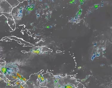
we have out there a Surface Low brought by a Tropical Wave E to W, walking WWNW to be precise.
as usual, thatTropical Wave is a elongated area from N to S, moving Westward.
it carries the Low in it's middle and that Low show's to this moment no circulation nor heavy thunderstorm areas,
so we have no indicators given that would let us await anything big in the make.
a TD could form tomorrow or by Wednesday,
BUT on the Wave's S the mid level winds are blowing E to W, a windshear counterproductive to a forming storm's counterclockwise circulation.
to it's NW the whole formation is running into a nice layer of dry saharan air, an other piece that slows/bothers formation.
and then, closer to the Windward Islands, we have such mid level winds blowing 30Knots W to East where then the Wave's/Storm's Northside of such counterclockwise rotating center would be.
I can't magically predict all involved factors for almost a week in advance on a 1500 miles long journey,
but the actual conditions and the outlook on their "movement/changes" at This Moment,
do tell me that we will not see anything big, not even anything with a name out of this one.
a TD the next couple days would be the maximum power i would see.
we keep watching, these curfew days we anyways have nothing better to do in the evenings,
but by now we have no danger out there for our Isle.
ADDY:
to a shit internet connection here my shown outlook and screenshots are from this afternoon 3/4PM.

_LI.jpg")
_LI.jpg")
NHC raised the bar to 60% chances that the Invest becomes a Storm.
the simple reality:
nothing changed since the system is up and moves on a good 10mphrs W, traveling with a elongated normal Tropical Wave.
the Surface Low did not organice anything, shows no circilation and contains no heavy thunderstorm areas.
sure winds in the center of the Low could reach windspeeds, that would determine it as a TD,
it could do so tomorrow, it could already have had such winds today, but such does not make a Storm in the make to become a Cyclone.
we have out there a Surface Low brought by a Tropical Wave E to W, walking WWNW to be precise.
as usual, thatTropical Wave is a elongated area from N to S, moving Westward.
it carries the Low in it's middle and that Low show's to this moment no circulation nor heavy thunderstorm areas,
so we have no indicators given that would let us await anything big in the make.
a TD could form tomorrow or by Wednesday,
BUT on the Wave's S the mid level winds are blowing E to W, a windshear counterproductive to a forming storm's counterclockwise circulation.
to it's NW the whole formation is running into a nice layer of dry saharan air, an other piece that slows/bothers formation.
and then, closer to the Windward Islands, we have such mid level winds blowing 30Knots W to East where then the Wave's/Storm's Northside of such counterclockwise rotating center would be.
I can't magically predict all involved factors for almost a week in advance on a 1500 miles long journey,
but the actual conditions and the outlook on their "movement/changes" at This Moment,
do tell me that we will not see anything big, not even anything with a name out of this one.
a TD the next couple days would be the maximum power i would see.
we keep watching, these curfew days we anyways have nothing better to do in the evenings,
but by now we have no danger out there for our Isle.
ADDY:
to a shit internet connection here my shown outlook and screenshots are from this afternoon 3/4PM.