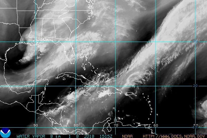
theapproaching Tropical Wave mentioned yesterday, is moving very slow.
it does not show any signs of a stormy development and surrounding conditions would not allow such for the next several days.
it's "Cnter" passed over the Leeward Islands and is now located NE of Puerto Rico.
that position is hard to spot on Satelite loops, as the wave carries most moisture now on it's South,
slowing down speed and showing behavior of a Vaguada styled piece that tries to concentrate all water on that southern portion, which will pass PR during topday and tomorrow slowly.
it is tracking on the exact Path of Hurricane Irma and should move along the PR Northshjores and then along the DR Northshores towards Florida, running between Cuba and the Bahamas.
as it's waters seem to concentrate on it's S it could become a danger due strong Rains over PR and then DR.
as a Vaguada such can last a couple days with strong waters specially where that concentration touches Mountains.
we have no stormy dangers anywhere in sight for this weekend,
but who lives around our mountainous areas and near Rivers of sucharaes should keep an eye up in the Skies and stay away from the anyways already saturated/high water level running flood prone areas.
Mike