Sanwiched Jose is still a Cat2 Cyclone running about 100mphr winds.
sure as he.ll it avoids the Irma conditions on it's West, the same time it already bounced from/came too close to a over 1020mb Wall on it's North, hence Jose is already Turning.
it's actual Heading is 360 degrees, straigt north.
tonight that Turn will continue, buy tomorrow Noon it should be already wandering the for a Hurricane weird Est Heading
and continue during the day the Turn to wander into the rarest of all directions, Heading SE.
that clockwise turn will continue til Jose did a Turn of about a full 360 Degrees, from it's formerly NW Heading a right turn til again a NW Heading.
conditions do not indicate that the Storm would intensify during that whole weird move,
but it can easily hold still Hurricane Powers when again heading NW'wards along the Bahamas but several hundred miles North out on Sea, towards the Carolinas.
the Atlantic High Ridge will be positined very different then, the models expect it to be gone/way back/weak, as they are in agreement about the NW Heading again after mid week.
it may become "No Way Jose" for the books, as it know's No Way where to go.
here you see the HigH Pressure Barriers taking Jose hostage as a Sandwich fillet:
as a Storm Jose is not in very good shape,
such weird Moves/Turns are against such Cyclones Nature when wandering North of the Equator,
but still producing Cat2 powers tonight it could still be on lower Hurricane Forces by Thursday afternoon
and get it's Core organized again once back on the used to NW Heading.
we will see what the present conditions for intensification and Heading will be for after Mid Week.
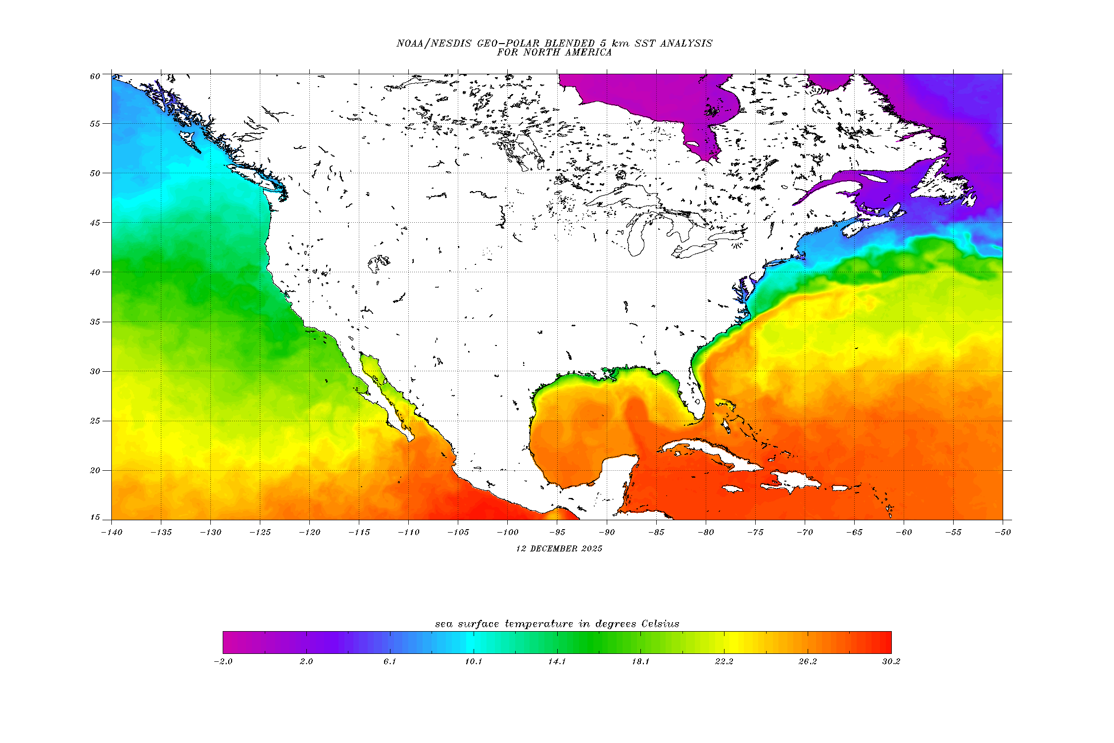
Sea Surface Temps are not in the Hostile Range to cool down a Storm,
but they are far from Hot Waters to fuel a recovering Storm quickly.
so many days ahead of time I would say it will not really recover, nothing quick and nothing strong,
getting steered out back over open water for the last time then way off the US Central East Shores,
bring it further North on the Map over real cooler waters to take all fuels away and let it die there
Tuesday/Wednesday next week somewhere between North Carolina and Bermuda,
without coming into vicinity of any Landmass ever.
to see this map do a "right mouse click" and choose the option "open image in a new window".
I don't know why, but many of the weather images show on DR1 this weird and can only be seen on their full scale when opening them in a new window.
Disturbance1, West of the Cape Verde's,
will not develop into anything, conditions did not build up.
it will be up north at the graveyard well before reaching the half way point of the Highway.
an significant effect of this Disturbance is that it su.cked up all the nice dry air shied over the Highway.
but we have already a new Shield up on the farest East, right off the African Westcoast,
so what ever activity will be tried by the next Disturbed Weather Area, which will leave Africa tonight to hit Atlantic Waters, it will be low key activity running into a dry air barrier right from the start.
Mike


