2023 Hurricane Season

Status
Not open for further replies.

MikeFisher

The Fisherman/Weather Mod
Feb 28, 2006
13,832
2,326
113
Punta Cana/DR
www.mikefisher.fun
It is not coming closer, it is heading NW, means walking parallel to us now.
Forward Speed get's slower and slower, the storm is getting wider due that, so then you are right, it is coming a tad bit closer.
The wind shear to it's N hindered that it could get powers back quickly,
but its widening is rising the powers of the watermasses moved around by the Storm.
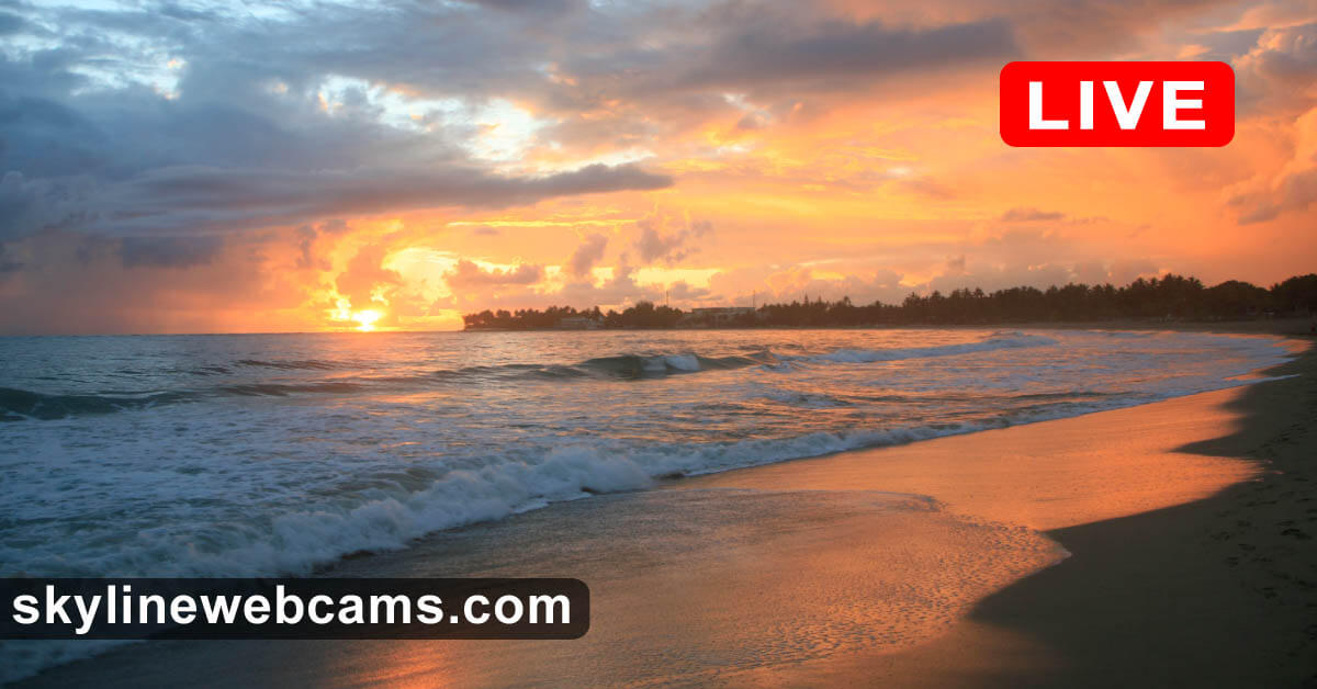
We already saw here on the SE off Cap Cana/Punta Cana the white caps of the Ocean this weekend, means super wild offshore conditions outside of the reefs.
That was just the beginning, we will continue to see those white caps and all on rising levels All Week Long this week.
Hurricane Lee is moving forward on just 7mphr, so it will take forever to pass by and move out and stop to have influence on our ocean conditions.
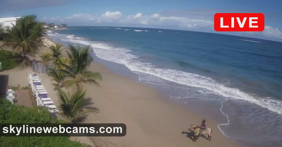
Considering the poor planned constructions at many hotels here in the PC Area, built way too close to the water, I can imagine that Lee will do a lil clean up in some areas where the surf is usually anyways higher than the average more S like along Bavaro Beach,
Like El Cortecito Beach, then Arena Gorda Beach in the area of Bahia Principe and Majestic Hotels and of course up in Uvero Alto, where the reefs are very close to the beaches, in those areas we will very likely use significant Sand/Beach/Land loss.
 

windeguy

Platinum
Jul 10, 2004
42,577
6,196
113
Close? But no cigar for the DR - on to Canada after it blows by Bermuda to the west:

(It isn't and wasn't really that close to the DR)

085434_5day_cone_with_line_and_wind.png

As for the waves in Cabarete, not much at this time:


windeguy

Platinum
Jul 10, 2004
42,577
6,196
113
Sure as hell is no breeze today at my beach

The calm before the storm????
Methinks the storm is already gone. But the local experts say 'manana" according to a post in DR1 news.
That would be for huge wave action here in Cabarete. The wind field is nowhere near us and heading further away every moment.
 

MikeFisher

The Fisherman/Weather Mod
Feb 28, 2006
13,832
2,326
113
Punta Cana/DR
www.mikefisher.fun
All the fishermen have pulled their boats far from the water

They must know or hunch something
For the East Shores, of course the Ocean Activities like fishing are closed.
You are a piece further away and will get all that 24hrs later, those waves move slow by constantly and unstoppable.
My buddy and offshore yacht skipper is at this moment in the air on his way from PUJ to San Juan/PR to bring tomorrow or Thursday a Yacht back from San Juan to Cap Cana.
I spoke to him 15 minutes ago, the Ocean out there on the Channel is a real wild thing, it is all violent white caps all the way, something we do not see very often out there. He is ready for a wild ride bringing the boat back, but use to powerful conditions on the 70+Ft machine.
By Thursday/Friday he has to leave Cap Cana again with a similar Yacht, to bring it to West Palm Beach/Fl on a way longer but similar conditions ride.
Maybe that one will get postponed by a day or two.
Today(11:00AM update) so far no changes on Hurricane Lee.
It is slow and we will watch it for an other week.
EDIT to add:
Conditions on our South/Caribbean Sea are the opposite, in the shaddow of the Island, around Saona Island flat calm conditions, which is tyical when high powers work on the NE.
 

MikeFisher

The Fisherman/Weather Mod
Feb 28, 2006
13,832
2,326
113
Punta Cana/DR
www.mikefisher.fun
No news on the afternoon update.
The storm is slowing down and in process of it's long time taking turn to go north.
the actual heading is as forecasted WNWwards.
it's maximum wind forces are down on 115mphr, that's normal for a big storm on canging face, to go up and down a bit every few hours,
it will stay on the edge of a Cat 2-Cat3 Hurricane during this process.
It's size of influence keeps growing as awaited, we shall get our waves, of course no winds nor rains, the opposite, it is actually here at my place super hot, zero wind of anything, today alone my solar panels had sunlight to charge the 4 battery banks for a whole year in just one day, IF i would have a 100 more banks for storage, lol.
I await for my area here in PC a full week of very hot and super humid without any winds to name aa lil breeze or such,
and the Sea out front to be on it's wildest of the year.
We keep watching, in case anything would significantly change, of course.
 

XTraveller

Well-known member
Aug 21, 2010
656
307
63
No news on the afternoon update.
The storm is slowing down and in process of it's long time taking turn to go north.
the actual heading is as forecasted WNWwards.
it's maximum wind forces are down on 115mphr, that's normal for a big storm on canging face, to go up and down a bit every few hours,
it will stay on the edge of a Cat 2-Cat3 Hurricane during this process.
It's size of influence keeps growing as awaited, we shall get our waves, of course no winds nor rains, the opposite, it is actually here at my place super hot, zero wind of anything, today alone my solar panels had sunlight to charge the 4 battery banks for a whole year in just one day, IF i would have a 100 more banks for storage, lol.
I await for my area here in PC a full week of very hot and super humid without any winds to name aa lil breeze or such,
and the Sea out front to be on it's wildest of the year.
We keep watching, in case anything would significantly change, of course.
Thank you Mike
 
  • Like
Reactions: MikeFisher

william webster

Platinum
Jan 16, 2009
30,246
4,331
113
I don’t see anything remarkable yet at my daily beach

As I said, the fishermen have their boats way up from shore
 

MikeFisher

The Fisherman/Weather Mod
Feb 28, 2006
13,832
2,326
113
Punta Cana/DR
www.mikefisher.fun
No changes over night.
Hurricane Lee moves slowly WNW on just a 7-8mphr forward speed.
It's windfields for Hurricane Force and TS Force Winds are super large, the Storm is still growing on size while it's wind powers are past their tops.
Due that the waves brought around very far stay on full force and even expand the areas of reach.
Like with Sandy, which was just a Tropical Storm Wind Force, but super large and it's storm surge hit on top of the highest natural tide of the year.
 

MikeFisher

The Fisherman/Weather Mod
Feb 28, 2006
13,832
2,326
113
Punta Cana/DR
www.mikefisher.fun
South on the North Shore.
Maybe a special compass? hehe.
From the S there will not come any bad.
We are today on the "S", in the Caribbean Sea at Saona Island, flat calm ocean conditions, perfect weather,
while at home on the E the stuff is offshore a full shi.t show.
 

cavok

Silver
Jun 16, 2014
10,041
4,380
113
Cabarete
Looking at the ocean from my balcony, it looks like a pretty normal day so far here in Cabarete. My beach faces to the ENE. Very light to almost no wind.
 
  • Like
Reactions: MikeFisher

MikeFisher

The Fisherman/Weather Mod
Feb 28, 2006
13,832
2,326
113
Punta Cana/DR
www.mikefisher.fun
No changes on the 11:00AM forecast.
Tracking stays the same, Lee slowed down forward speed to just 6mphr, a trend that should continue today and tonight.
Bermuda will be close to receive TS Winds or not, as it will be located on the strong winds right side of the Storm when passing Bermuda out on their West.
When passing the New England states and approaching Canadian Maritimes tracking straight N it will bring it's maximum storm surge towards it's N and NW and W to exactly those areas.
As they are very far away from ou7r Island Home, I do not check on the timing of natural high tides and arrival of the max storm surge for those areas, that timing will be key to differ between a rough day or a destructive bad wave force spilling far inland.
For us Islanders nothing changed and nothing is expected to change, the forecast been so far since a full week out amazingly accurate specially on the Tracking.
 
  • Like
Reactions: johne
Status
Not open for further replies.